


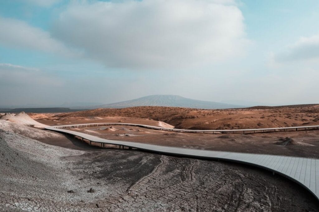
Azerbaijan‘s mountain landscape is shaped by the Lesser Caucasus and Greater Caucasus ranges, offering rugged rock formations, alpine meadows, and high-altitude vistas. Unlike volcanic regions, these peaks are primarily eroded and alpine, with some accessible for day hikes and others demanding multi-day efforts. The skyline features sharp ridges, snow-capped summits, and dramatic valleys, making it a compelling destination for mountain travelers seeking variety and challenge. This guide emphasizes routes that reward effort with stunning views and authentic mountain experiences.
The 17 peaks include a mix of technical climbs, scenic viewpoints, and cultural sites. Highlights like Mount Kapaz and Tufandağ offer accessible hikes, while Mount Bazardüzü and Mount Murovdağ challenge experienced trekkers. Some peaks, such as Shahdag Mountain Resort and Tufandağ Gabala Ski Resort, are more about scenery and leisure. Whether you seek a quick summit or a multi-day traverse, this country’s mountains cater to diverse fitness levels and adventure styles. If you want high-altitude scenery or cultural encounters, this guide is for you; if you prefer easy day hikes, stop here.

Key takeaways
- Choose Mount Bazardüzü for a guided ascent; the route from Laza valley is the most reliable and offers stunning glacier views.
- Avoid overrating Mount Goyazan; it’s a short climb with limited elevation gain, better suited for a quick viewpoint than a serious summit.
- Plan your trip to Mount Shahdagh between July and September for the best weather and fewer crowds.
- Tufandağ is ideal for a 4-6 hour day hike, perfect for those with moderate fitness seeking high-altitude scenery.
- Lökbatan Mud Volcano is a unique geological feature best viewed from the boardwalk; no climbing required.
- Mount Murovdağ demands a local guide and a full day; it’s worth the effort for its remote ridge views and alpine terrain.
- Visit Xanlar in spring or autumn to avoid summer crowds and enjoy the mountain’s cultural sites and scenic landscape.
- The highest peak, Mount Bazardüzü, requires a state border permit and expert guidance; never attempt solo without proper preparation.
The peaks at a glance
| Peak | Type | Region | Effort | Why it is on the list |
|---|---|---|---|---|
| Mount Kapaz | High alpine mountain | Lesser Caucasus | Moderate 3-4h hike | Rising 3,065 meters with panoramic views of the Caucasus |
| Yarudağ | High mountain peak | Greater Caucasus | Moderate 4-5h trek | Fourth highest in Azerbaijan at 4,116 meters |
| Mount Shahdagh | High alpine peak | Qusar District | Moderate 4-5h hike | Close to Russia border with 4,243 meters elevation |
| Lökbatan Mud Volcano | Mud volcano | Absheron Peninsula | Drive-up, short walk | Geothermal mud cones near Baku |
| Mount Goyazan | Rocky hilltop | Qazakh District | Easy 1h walk | 858 meters with fortress ruins and views |
| Qazangöldağ | Mountain in highlands | Zangezur Mountains | Moderate 3-4h trek | Rises 3,829 meters between Armenia and Nakhchivan |
| Xanlar | Hill with cultural sites | Western Azerbaijan | Easy walk | Historic religious sites and scenic landscape |
| Tufandağ | High mountain peak | Qusar District | Moderate 4-5h trek | Third highest at 4,191 meters with alpine terrain |
| Hinaldag | Mountain ridge | Dashkasan District | Easy 2h walk | Source of rivers with lush forests |
| Bozdag | Mountain near reservoir | Mingachevir | Drive-up, short walk | Flowing Kura River and reservoir views |
| Kiçik Kirs Dağı | Mountain peak | Karabakh Range | Moderate 3h hike | 2,346 meters with border views |
| Böyük Kirs Dağı | High mountain | Karabakh Range | Moderate 3-4h trek | Highest in the range at 2,725 meters |
| Mount Bazardüzü | Glaciated summit | Greater Caucasus | Expert 2-day climb | Highest peak at 4,466 meters with border permit |
| Mount Babadağ | Sacred mountain | Greater Caucasus | Moderate 2-3h hike | Pilgrimage site with cultural significance |
| Mount Murovdağ (Gamish) | High mountain ridge | Lesser Caucasus | Hard 2-day trek | 3,724 meters with remote alpine terrain |
| Shahdag Mountain Resort | Ski resort | Qusar District | Easy 1h from town | Seasonal ski runs and summer excursions |
| Tufandağ Gabala Ski Resort | Ski area | Gabala | Easy 1h from Gabala | 14 runs and gondola access for scenic views |
Where the peaks are
Every peak in depth
Prefer a guide for the harder climbs? Local operators run permitted, guided trips on the peaks below.
Mount Kapaz – Central Azerbaijan’s High Alpine Sentinel
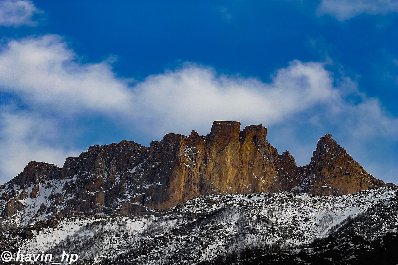
Climb Mount Kapaz via a moderate 3-4 hour hike across rocky slopes and alpine meadows. The trail ascends gradually, offering views of the surrounding Lesser Caucasus. At the summit, expect panoramic vistas over Ganja and the Caucasus range. The terrain is mostly loose scree and grassy patches, so pace yourself on the steeper sections. Be prepared for variable weather; wind can pick up quickly at the top. Avoid rushing; the effort pays off with a commanding view of the central Caucasus. Do not attempt in poor weather conditions, as the terrain can become treacherous.
How this peak formed
Mount Kapaz is a volcanic mountain formed by uplift and erosion of the Lesser Caucasus volcanic arc. Its rocks are primarily andesite and basalt, shaped by past volcanic activity. The mountain’s structure reflects complex tectonic interactions in the region, with evidence of ancient lava flows and volcanic cones. Its summit area features exposed volcanic rock and sparse alpine vegetation, typical of high-altitude volcanic formations. The mountain’s geological history includes multiple eruptions, but it is currently dormant, with no recent activity reported.
What to see (5)
- ▸ Reach the summit for sweeping views of Ganja and the Lesser Caucasus
- ▸ Spot volcanic rock formations and lava remnants near the top
- ▸ Enjoy the panoramic vista of the Caucasus range to the north
- ▸ Observe alpine flora and scattered scree slopes along the trail
- ▸ Capture the mountain’s profile against the sky at sunrise or sunset
Visit early in the morning or late afternoon to avoid the small but steady local groups that tend to arrive midday.
Carry a lightweight jacket; summit winds can be strong even in summer, and weather shifts quickly.
Yarudağ – The Fourth Highest Peak in Azerbaijan
Approach Yarudağ via a moderate 4-5 hour trek through rugged terrain and alpine meadows. The trail climbs steadily, with sections of rocky footing and sparse vegetation. As you ascend, the views of the Greater Caucasus become more dramatic, especially near the summit. The final push involves navigating a rocky ridge with some exposure, so stay alert. From the top, gaze over the expansive Caucasus landscape, with distant peaks and valleys. The trail is less crowded, but be prepared for high-altitude conditions and changing weather. Do not underestimate the altitude; acclimatize properly before the climb.
How this peak formed
Yarudağ is part of the Greater Caucasus range, formed by the collision of the Eurasian and Arabian tectonic plates. Its geology is dominated by metamorphic rocks, including schist and gneiss, shaped by intense folding and faulting. The mountain’s uplifted strata reveal complex geological processes that have created its rugged profile. Its high elevation results from tectonic compression, with erosion exposing older metamorphic formations. The mountain’s geological history includes multiple glaciations, which carved out its current rugged features.
What to see (5)
- ▸ Reach the rocky summit for commanding views of the Caucasus
- ▸ Traverse the alpine meadows and wildflower patches en route
- ▸ Spot distant peaks of the Greater Caucasus range
- ▸ See the rugged ridges and glacial valleys below
- ▸ Capture the mountain’s silhouette against dawn or dusk
Hike on weekdays or start early to avoid the small but persistent local groups that visit midday.
Use trekking poles for stability on rocky sections and carry layers for rapid weather changes.
Mount Shahdagh – The Border-Adjacent High Peak
Climb Mount Shahdagh via a 4-5 hour moderate hike through forested slopes and alpine zones. The trail ascends steadily, with sections of rocky terrain and sparse shrubbery. Near the summit, expect a rocky outcrop with views into Russia’s Dagestan. The ascent offers glimpses of the mountain’s glacial remnants and rugged ridges. At the top, enjoy panoramic views of the Caucasus and the border region. The trail is well-trodden but can be slippery after rain, so wear sturdy footwear. Be cautious of sudden weather shifts at altitude. Do not attempt in poor weather, as exposure can be dangerous.
How this peak formed
Mount Shahdagh is part of the Greater Caucasus range, formed by the collision of the Eurasian and Arabian plates. Its geology features metamorphic rocks like gneiss and schist, shaped by intense folding and faulting. The mountain’s uplifted strata reveal a history of tectonic compression, with evidence of past glaciations carving its ridges and valleys. Its high elevation is a result of ongoing tectonic activity, with the mountain standing as a prominent feature of the region’s geological complexity.
What to see (5)
- ▸ Stand on the rocky summit for views into Dagestan
- ▸ See the remnants of ancient glaciers on the slopes
- ▸ Walk along the ridges with panoramic Caucasus vistas
- ▸ Spot the mountain’s rugged rock formations and fault lines
- ▸ Capture the mountain at sunrise with early light
Visit during weekdays or early morning to avoid the small groups that arrive midday at the resort base.
Bring a pair of binoculars to scan the distant border regions and mountain ridges.

Lökbatan Mud Volcano – Geothermal Wonder Near Baku
Open +
Visit Lökbatan Mud Volcano with a short drive and a brief walk, approximately 15-20 minutes. The site features bubbling mud cones and steaming vents, with minimal effort required. The area is active, with mud bubbling and gas escaping, creating a surreal landscape. The terrain is soft, with pools of thick mud and mineral-rich deposits. The site is quiet, with only a few visitors, making it ideal for a quick, unique stop. Be cautious around steaming vents and avoid touching the mud directly. The site is best visited in dry weather to prevent slipping.
How this peak formed
Lökbatan Mud Volcano is a geothermal feature formed by the upward movement of mud and gases through sedimentary layers in the Absheron Peninsula. Its activity is driven by underground pressure from natural gas and geothermal heat, causing mud to erupt and create cones. The mud is rich in minerals like silica and clay, which deposit around vents and form the characteristic cones. The region’s geology includes sedimentary rocks such as sandstone and claystone, with the mud volcanoes being a surface expression of deep geothermal processes.
What to see (5)
- ▸ Observe bubbling mud cones and steaming vents
- ▸ See mineral deposits forming around the vents
- ▸ Take photos of the surreal geothermal landscape
- ▸ Learn about geothermal activity in the region
- ▸ Spot nearby salt flats and mineral-rich pools
Visit early in the morning or late afternoon when the few visitors tend to arrive, avoiding midday crowds.
Bring waterproof footwear and a camera with a zoom lens to capture the mud eruptions up close.
Mount Goyazan – Fortress Ruins with Scenic Views
Open +
Reach Mount Goyazan with a simple 1-hour walk from the nearby village. The trail is gentle, ascending a rocky hilltop with a small fortress at the summit. The ascent is easy, with well-marked paths and minimal technical difficulty. From the top, enjoy views over the surrounding plains and the nearby villages. The summit features ancient fortress ruins, offering a glimpse into regional history. The terrain is rocky with sparse vegetation, so wear sturdy shoes. Avoid visiting during heavy rain, as rocks can become slippery. The site is rarely crowded, making it a peaceful stop.
How this peak formed
Mount Goyazan is a volcanic hill formed by ancient volcanic activity in the region. Its rocks are primarily andesite and tuff, shaped by erosion over millennia. The mountain’s steep slopes and rocky summit are the result of volcanic uplift and subsequent weathering. Its geological history includes volcanic eruptions during the Miocene epoch, with the remaining volcanic rocks now exposed on the summit and slopes. The mountain stands as a prominent feature of the Qazakh District, with a landscape shaped by volcanic and erosional processes.
What to see (5)
- ▸ Explore the ancient fortress ruins at the summit
- ▸ Enjoy panoramic views over the plains and villages
- ▸ See volcanic rocks and tuff formations up close
- ▸ Walk along the rocky ridge with scenic vistas
- ▸ Capture the mountain’s silhouette at sunrise or sunset
Visit early in the morning on weekdays to enjoy solitude and clear views without the weekend visitors.
Bring a camera with a wide-angle lens to capture the fortress ruins against the landscape.
Qazangöldağ – High Mountain in the Zangezur Range
Open +
Approach Qazangöldağ via a 3-4 hour trek through highland terrain and alpine meadows. The trail climbs steadily, crossing rocky slopes and patches of snow in early season. The ascent offers views of the surrounding mountains and the border region with Armenia. The summit rises over 3,800 meters, with a rugged profile and steep slopes. Expect a mix of scree, loose rocks, and alpine grasses. The final section involves a moderate scramble over rocky terrain. At the top, take in views of the Zangezur Mountains and distant peaks. The trail is remote, so carry sufficient water and gear. Avoid in bad weather, as altitude and terrain can be hazardous.
How this peak formed
Qazangöldağ is part of the Zangezur Mountains, formed by complex tectonic processes involving the collision of the Arabian and Eurasian plates. Its geology includes sedimentary and metamorphic rocks, such as limestone and schist, shaped by folding and faulting. The mountain’s high elevation results from ongoing tectonic compression, with uplifted strata exposed by erosion. Its rugged profile reflects a history of glacial carving and tectonic uplift, with evidence of past seismic activity shaping its steep slopes and rocky outcrops.
What to see (5)
- ▸ Reach the summit for views over the Armenian border
- ▸ Traverse rocky slopes with patches of snow in early season
- ▸ See the rugged peaks of the Zangezur range
- ▸ Spot glacial valleys and alpine meadows below
- ▸ Capture the mountain’s silhouette at dawn or dusk
Hike during weekdays or early morning to avoid the small groups that arrive midday from nearby villages.
Use trekking poles for stability on loose terrain and carry layers for rapid weather shifts.

Xanlar – Cultural Heritage with Scenic Views
Open +
Reach Xanlar with a short walk from the village, approximately 30 minutes. The site features a hill with historic religious structures and scenic landscape. The terrain is gentle, with well-maintained paths and some stone steps. From the top, enjoy views of the surrounding valleys and distant mountains. The site includes old churches and ruins, offering a glimpse into regional history. The area is quiet, with few visitors, making it ideal for a peaceful visit. Be respectful of the historic structures and avoid climbing on fragile ruins. Avoid visiting during rain, as paths can be slippery.
How this peak formed
Xanlar is a hill composed of sedimentary rocks, mainly limestone and sandstone, shaped by erosion and tectonic uplift. Its layered formations reveal a history of sediment deposition in ancient seas, later uplifted by regional tectonic forces. The hill’s gentle slopes and terraced landscape are the result of weathering and erosion over millennia. The region’s geology reflects a complex history of marine sedimentation, faulting, and uplift, creating a scenic backdrop for the historic sites.
What to see (5)
- ▸ Visit the ancient church ruins at the hilltop
- ▸ Enjoy panoramic views of the valleys below
- ▸ Explore the stone terraces and old pathways
- ▸ See the scenic landscape with surrounding mountains
- ▸ Capture the site at sunrise or late afternoon light
Visit early in the morning on weekdays to enjoy solitude and avoid the small weekend groups.
Bring a camera with a telephoto lens to capture distant mountain views and historic details.
Tufandağ – The Third Highest Peak in Azerbaijan
Open +
Climb Tufandağ via a 4-5 hour trek over steep, rocky terrain and snow patches in early season. The trail ascends through alpine meadows and rugged ridges, with some sections requiring careful footing. The final approach involves navigating a rocky summit ridge with some exposure, so stay alert. From the top, enjoy sweeping views of the Caucasus and surrounding valleys. The trail is less crowded than other peaks, but weather can change rapidly, so carry appropriate gear. Expect a challenging ascent with significant elevation gain, so pace yourself. Do not attempt in poor weather or if unprepared for high-altitude conditions.
How this peak formed
Tufandağ is a high mountain peak formed by tectonic uplift associated with the Greater Caucasus range. Its rocks are mainly granite and gneiss, shaped by glacial erosion and faulting. The mountain’s rugged profile reflects a history of tectonic compression and glacial carving, with steep slopes and sharp ridges. Its geological formation is linked to the collision of the Eurasian and Arabian plates, resulting in uplift and deformation of crystalline basement rocks. The summit area exposes crystalline rocks, with evidence of past glaciations shaping its current form.
What to see (5)
- ▸ Reach the rocky summit for panoramic views of the Caucasus
- ▸ Traverse alpine meadows and snow patches in early season
- ▸ See the rugged crystalline rocks and fault lines
- ▸ Spot glacial valleys and high ridges below
- ▸ Capture the mountain at sunrise with early light
Hike during weekdays or early morning to avoid the small groups that arrive midday from the valley.
Use trekking poles for stability and carry layers for rapid weather changes.
Mount Murovdağ (Gamish) – Remote Peak for the Experienced
Elevation 3724 mClimb hardBest months Jul, Aug, SepOpen +
Climb Mount Murovdağ if you seek a challenging ascent with minimal crowds. The route involves rugged terrain and a steep ridge, demanding solid fitness and navigation skills. Expect a strenuous 12-15 hour round trip from the Gadabay approach, with no marked trail to the summit. The ascent offers views of Ganja and the surrounding uplands, but the terrain is rocky and exposed near the top. Arrive early to avoid afternoon weather changes and ensure safety. The route is best suited for those comfortable with alpine conditions and off-trail navigation. Do not attempt without a local guide if unfamiliar with the area. The summit provides a panoramic view of the Lesser Caucasus, with distinctive erosion features and sharp ridges.
How this peak formed
Mount Murovdağ is shaped by tectonic uplift within the Lesser Caucasus range. Its rocks are primarily metamorphic schists and gneisses, formed during regional mountain-building processes. The peak’s rugged profile results from erosion and faulting over millions of years, creating sharp ridges and deep valleys. The mountain’s geological history reflects complex tectonic interactions that uplifted the crust, exposing metamorphic rocks at high elevation. Glacial erosion carved out some of the steep slopes, especially on the northern face. The summit’s rocky outcrop is a testament to the mountain’s dynamic geological past, with little vegetation at the highest altitudes.
What to see (5)
- ▸ Reach the rocky summit ridge for expansive views of the Lesser Caucasus
- ▸ Spot the fault lines and metamorphic rock outcrops along the ascent
- ▸ Observe the deep valleys carved by glacial erosion on the northern slopes
- ▸ See the distant Ganja uplands from the high vantage point
- ▸ Identify the sharp ridges and unique erosion features near the summit
Visit during weekdays in late summer when local guides take groups, avoiding weekends when the route sees more independent climbers.
Carry a GPS device with offline maps; the route is unmarked and navigation-critical near the summit.
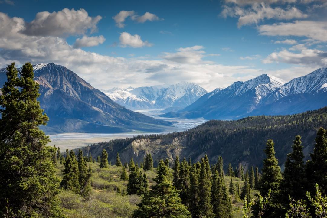
Shahdag Mountain Resort – Easy Access for Scenic Views
Elevation 2550 mClimb easyBest months Jan, Feb, Mar, DecOpen +
The resort offers a straightforward way to enjoy high-altitude scenery without a strenuous climb. The gondola from the base station to 2,550 meters provides panoramic views of the Caucasus. During winter, the ski runs are the main attraction, but in summer, the mountain transforms into a hiking and sightseeing hub. The lifts operate from December to March, with summer excursions available on selected days. The resort is well-equipped with cafes, restrooms, and rental shops, making it suitable for a half-day outing. Expect moderate crowds during peak season, especially on weekends, but the main lifts and viewpoints remain accessible. Arrive early to beat the midday rush and secure a good spot at the top station. The scenic chairlift ride itself is a highlight, offering sweeping vistas of the surrounding peaks and valleys.
How this peak formed
Shahdag Mountain is part of the Greater Caucasus range, formed by the collision of the Eurasian and Arabian tectonic plates. The mountain’s geology consists mainly of sedimentary and metamorphic rocks, uplifted during mountain-building events over millions of years. The region features glacial valleys and alpine meadows, shaped by past glaciations that carved out the current landscape. The ski slopes are cut into the mountain’s layered sedimentary formations, with some areas showing evidence of faulting and folding. The mountain’s elevation and geological history contribute to its diverse flora and fauna, with alpine grasses and hardy shrubs thriving at higher altitudes.
What to see (5)
- ▸ Ride the gondola for sweeping views of the Caucasus
- ▸ Visit the panoramic observation deck at the top station
- ▸ Explore the mountain trails accessible from the lift stations
- ▸ See the alpine meadows and wildflowers in summer
- ▸ Enjoy the mountain scenery from the ski runs in winter
Visit during weekdays in the shoulder seasons of spring or autumn to enjoy quieter gondola rides and viewpoints.
Book gondola tickets online in advance to skip queues during peak winter months.
Tufandağ Gabala Ski Resort – Scenic Day Trip for Winter Views
Elevation 1920 mClimb easyBest months Jan, Feb, Mar, DecOpen +
Tufandağ offers a quick, accessible winter escape with a gondola from Gabala to 1,920 meters. The 14 runs cater to all skill levels, with a top station restaurant providing views down to the town. The gondola ride itself is a highlight, especially in clear weather, offering vistas of the surrounding mountains and forests. The slopes are groomed daily during the season, which runs from December to March. The resort is moderate in size, making it ideal for a day trip without long waits or crowds. Arrive early at the gondola base to secure a good spot and avoid the midday rush. The terrain is gentle enough for beginners but also offers some steeper runs for advanced skiers. Summer visits are possible via the cable car, which takes you to the mountain meadows for hiking and sightseeing.
How this peak formed
Tufandağ is part of the Caucasus mountain system, formed by the collision of tectonic plates that uplifted sedimentary and metamorphic rocks. The mountain’s slopes are shaped by glacial and erosional processes, with the underlying geology comprising mainly limestone and shale layers. The mountain’s elevation and geological composition create a variety of terrain, from forested slopes to open alpine meadows. The region’s geological history includes past glaciations that carved out the valleys and shaped the current landscape, with the mountain’s layered rocks visible along the ski runs and trails.
What to see (5)
- ▸ Ride the gondola for panoramic mountain views
- ▸ Ski or snowboard down the well-groomed slopes
- ▸ Enjoy the mountain vistas from the top station restaurant
- ▸ Explore the mountain meadows accessible via cable car in summer
- ▸ Capture scenic photos of forests and peaks from the slopes
Visit early in the season or on weekdays to avoid weekend crowds and enjoy quieter slopes and gondola rides.
Rent a helmet and goggles in advance; the mountain can be windy and cold even in winter.
When to Visit Azerbaijan’s Mountains
The best months are July and August for most peaks, especially Mount Shahdagh and Tufandağ Gabala Ski Resort. Avoid winter if you want to hike or climb; snow and cold limit access. Spring and early fall are good for scenic routes.
Summer from July to September offers the clearest views and safest conditions for climbing Mount Shahdagh and Yarudagh, with minimal rain and snow. June and October can be transitional, with unpredictable weather. The winter months bring snow and ice, making high-altitude ascents dangerous and often inaccessible, especially on peaks like Mount Shahdagh and Tufandağ Gabala. For scenic viewpoints, late spring and early fall provide stable weather and fewer crowds, ideal for day hikes and photography. The high Caucasus peaks are best in summer, while lower elevations like Mount Goyazan remain accessible year-round, weather permitting.
Lower peaks such as Mount Goyazan and Xanlar are accessible year-round, though winter snow can complicate travel. High summits like Mount Shahdagh and Yarudagh are best climbed from late June to early September, when snow melts and weather stabilizes. Outside this window, snow and ice pose serious risks, and permits or guides are often mandatory. The timing for the highest peaks is narrow, typically July and August, due to snow cover and weather conditions. In contrast, mud volcanoes like Lökbatan Mud Volcano are accessible anytime, with no seasonal restrictions.
Staying Safe in Azerbaijan’s Mountain Terrain
Azerbaijan’s mountains offer rewarding views but demand respect for their unpredictable weather and terrain. Proper planning, local guidance, and awareness of hazards are essential to avoid accidents. Always check current conditions before heading into remote areas, especially on high peaks like Mount Shahdagh and Yarudagh.
- Avoid climbing Mount Shahdagh without a guide; the glacier routes and high-altitude crevasses pose serious danger, especially in late season when ice is unstable.
- Never descend into the crater of Lökbatan Mud Volcano without local advice; the mud and gas emissions can be hazardous, and the terrain is unpredictable.
- Be cautious on Mount Goyazan, where loose rocks and steep slopes increase the risk of falls, especially during wet weather or after rain.
- Monitor weather forecasts closely when attempting Yarudagh; sudden storms and fog are common, and visibility can drop rapidly, making navigation difficult.
- Stay alert near Mount Kapaz, which has no recent eruptions but can experience sudden weather changes and altitude sickness at higher elevations.
- If venturing near Mount Babadağ during the pilgrimage season, be aware of large crowds and non-technical routes that can lead to congestion and accidents.
Preparing for Mountain Adventures in Azerbaijan
Azerbaijan’s peaks range from moderate hikes to technical ascents, often in remote and high-altitude environments. Proper preparation ensures safety, enjoyment, and the ability to handle variable weather and terrain. Focus on acclimatisation, gear, and local regulations to avoid common pitfalls and maximize your experience on peaks like Mount Bazardüzü or Mount Shahdagh.
Research peak-specific permit requirements
Check if your chosen peaks, such as Mount Bazardüzü or Mount Shahdagh, require border permits or guides. Some areas demand official permits or a licensed guide, especially for high-altitude or border-region climbs.
Build fitness for high-altitude trekking
Engage in cardiovascular and strength training focused on mountain hiking, including long hikes with a loaded pack. Prepare for multi-hour ascents on peaks like Mount Murovdağ or Yarudağ.
Verify gear and clothing
Ensure you have layered clothing suitable for Azerbaijan’s mountain climate, including waterproof shells, insulating layers, and sturdy hiking boots. Pack essentials like trekking poles, headlamp, and a first aid kit.
Plan acclimatisation and weather windows
Schedule your trip during the best months – July to September for peaks like Mount Shahdagh or Tufandağ. Allow time for acclimatisation if tackling higher summits, and monitor weather forecasts closely.
Check local emergency contacts and regulations
Note emergency numbers and local authorities’ contacts. Understand regulations for drone use or protected sites, especially around Mount Goyazan or the mountain resorts.
Arrange guides or local transportation
Book local guides for technical peaks like Mount Bazardüzü or Mount Murovdağ. Confirm transportation options to trailheads, such as from Ganja or Qusar, and reserve permits if needed.
Test your navigation and safety equipment
Practice using GPS devices, maps, and compasses. Carry extra batteries and ensure your communication devices work in remote areas, especially near border peaks like Mount Shahdagh.
Prepare on the day of ascent
Start early, pack sufficient water and snacks, and review your route. Check local weather again, and inform someone about your plans, especially when approaching peaks like Yarudağ or Qazangöldağ.
Choosing the Right Mountain for Your Trip
Mount Shahdagh offers a moderate 4-5 hour ascent with well-maintained trails and accessible facilities. It provides high-altitude views without technical difficulty, making it ideal for those new to mountain trekking.
Bazardüzü is Azerbaijan’s highest peak at 4,466 meters, requiring a guided alpine expedition. It demands expert guidance and permits, but rewards with panoramic glacier views and a true alpine challenge.
This sacred peak hosts a pilgrimage tradition, with a non-technical hike during the pilgrimage week. It offers cultural insight and scenic views, suitable for those interested in regional history and spirituality.
A remote, rugged peak for experienced climbers. Its steep ridges and alpine terrain require a local guide and full day, but the solitude and expansive views justify the effort.
Xanlar is a gentle hill with historic ruins and scenic landscape, accessible via a short walk. It’s perfect for families with teens seeking cultural heritage and easy mountain scenery.
Mountain Peaks in Azerbaijan – Practical Questions
1Do I need a permit to climb Mount Bazardüzü?
Yes, a permit from the Azerbaijani border authorities is mandatory for Mount Bazardüzü. It is strictly guided, and solo attempts are not allowed. Arrange your permit through a licensed local guide well in advance, as processing can take several weeks.
2Is climbing Mount Goyazan worth it for a beginner?
Mount Goyazan is a short, easy climb with minimal technical difficulty, making it suitable for beginners. It offers scenic views and historic fortress ruins at the summit. It’s a good choice for a quick high-altitude experience without extensive planning.
3Are drones allowed on Mount Shahdagh?
Drones are generally prohibited in protected areas and near border regions like Mount Shahdagh. Check local regulations before flying, and always seek permission from authorities to avoid fines or confiscation.
4What water sources are available on the route to Yarudağ?
Water is scarce on the Yarudağ trail itself; carry sufficient supplies from Qusar. There are no reliable streams or springs near the summit, so plan to hydrate beforehand and use purification if collecting from remote sources.
5When is the best season to climb Tufandağ?
The optimal window for Tufandağ is July through September, when weather is most stable and snow has melted. Outside this period, snow and rain increase risks, and trail conditions deteriorate, making ascents more hazardous.
6Is Mount Murovdağ suitable for solo climbers?
No, Mount Murovdağ demands a local guide due to its rugged terrain and navigation challenges. Solo attempts are risky and not recommended, especially for those unfamiliar with alpine conditions or the area’s remoteness.
7Can I visit the mud volcanoes with children?
Yes, the Lökbatan Mud Volcano is safe for children, as it involves a short walk and minimal exposure. Keep a close eye on them around steaming vents and avoid touching the mud or gas vents for safety.
8What is the difficulty level of climbing Mount Kirs Dağı?
Mount Kirs Dağı is a moderate climb, suitable for fit hikers with some experience. The ascent involves rocky slopes and a short scramble, but no technical skills are required. It’s a manageable day trip for most active travelers.
Some links on this page are affiliate links. We may earn a small commission at no extra cost to you when you book through them.