


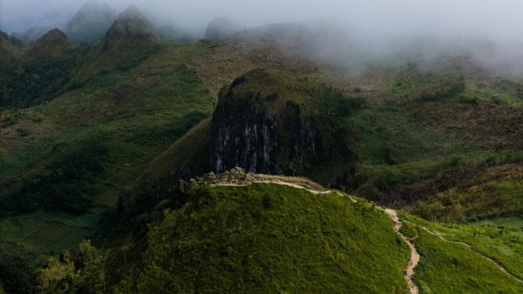
The Philippines’ mountains are volcanic giants and rugged alpine summits rising sharply from tropical lowlands. Expect steep gradients, volcanic ash fields, and thick mossy forests at altitude. The skyline is dominated by perfect cones like Mayon and crater lakes like Pinatubo, demanding technical fitness and early starts. This is summit-focused climbing, not casual hiking, with elevation gains often exceeding 1,900 meters and volcanic terrain that tests endurance and trail skills.
Among the 9 peaks, Mount Apo stands tallest at 2,954 meters with a technical climb to an active crater. Mount Pinatubo offers a moderate day trek to a turquoise crater lake, while Mount Pulag delivers a famous sea-of-clouds sunrise on a less demanding route. If you want a challenging volcano ascent or a high-altitude alpine summit, this guide is for you; if you prefer easy walks or cable cars, look elsewhere.

Key takeaways
- Choose Mount Apo for the highest summit and active crater, but prepare for a hard 2-3 day technical climb with 1,900+ meters elevation gain.
- Mount Pinatubo’s crater lake trek is a moderate day trip from Manila, best done November to April when jeep access is reliable.
- Skip Mount Mayon’s summit attempt due to frequent closures; instead, hike base trails for safe views of its perfect cone shape.
- Mount Pulag’s sunrise sea-of-clouds requires a pre-dawn start and is best climbed December through March for clear skies and cooler weather.
- Mount Kanlaon demands checking volcanic alert levels first, as it closes often; when open, expect a hard 3-day multi-trail expedition.
- Mount Guiting-Guiting is for expert climbers only, with rope-assisted scrambling on narrow ridges; do not attempt without serious experience.
- Mount Hibok-Hibok offers a quick 2-3 hour day climb on Camiguin Island, ideal for those seeking volcanic fumaroles without multi-day trekking.
- Plan your climb seasonally: rainy months make trails slippery and jeep access impossible, especially on Pinatubo and Pulag.
The peaks at a glance
| Peak | Type | Region | Effort | Why it is on the list |
|---|---|---|---|---|
| Mount Apo | Active volcanic stratovolcano | Mindanao | Hard 2-3 day trek | Active volcanic crater with fumaroles and steep alpine forest |
| Mount Pinatubo | Active crater lake volcano | Zambales | Moderate 4-5 hour hike | Cold turquoise crater lake formed after 1991 eruption |
| Mount Pulag | Alpine summit with grasslands | Cordillera Range | Moderate 2-day climb | Sunrise sea-of-clouds inversion over mountain peaks |
| Mount Mayon | Active perfect cone volcano | Albay | Easy base trail hikes | Iconic perfect cone shape visible from Daraga church |
| Mount Hibok-Hibok | Active volcanic cone | Camiguin Island | Moderate 2-3 hour day hike | Volcanic fumaroles and crater views on short climb |
| Mount Kanlaon | Active stratovolcano with sulphur vents | Negros Island | Hard 3-day trek | Wedge-shaped crater with continuous sulphur venting |
| Mount Bulusan | Active stratovolcano with lake | Sorsogon | Moderate day climb or lake circuit | Summit crater and mossy forest around Bulusan Lake |
| Mount Dulang-Dulang | High mossy forest peak | Mount Kitanglad Range | Expert multi-day trek | Dense mossy forest with no summit views |
| Mount Guiting-Guiting | Jagged technical alpine peak | Sibuyan Island | Expert 3-day climb | Knife Edge ridge requiring rope-assisted scrambling |
Where the peaks are
Every peak in depth
Prefer a guide for the harder climbs? Local operators run permitted, guided trips on the peaks below.
Mount Apo – Philippines’ Highest with a Steep Volcanic Crater Ascent
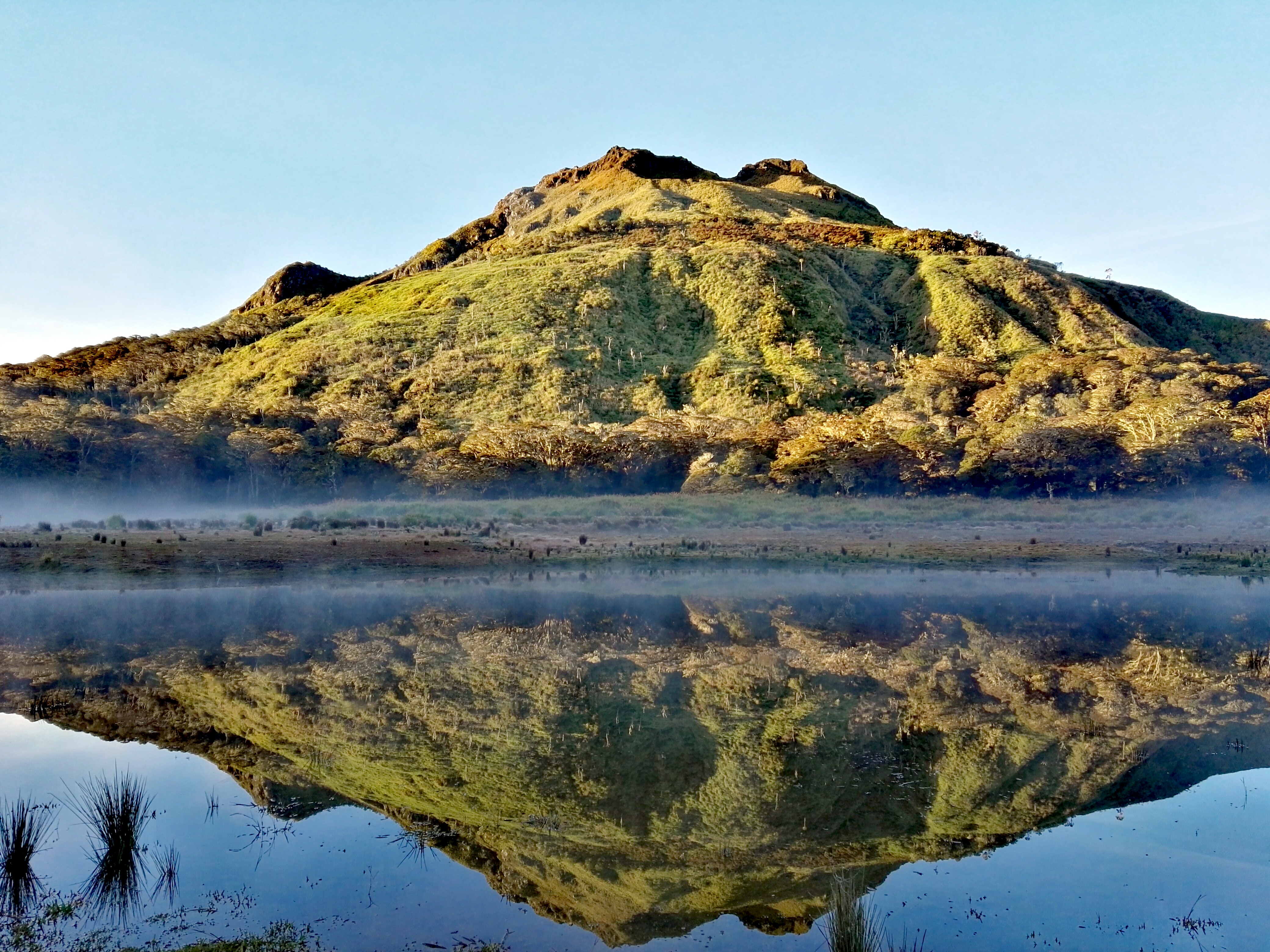
- Elevation: 2954 m
- Climb: hard
- Volcano: yes
- Best months: Mar, Apr, May
Climbing Mount Apo demands a tough 2-3 day trek through dense alpine forest with steep gradients and rocky volcanic soil. Expect a steady climb from 1,000 m base to the fumarolic crater above 2,300 m, where cloud cover often reduces visibility. The air thins noticeably near the summit, making pacing critical. The crater’s steam vents offer a rare volcanic atmosphere unmatched in the country. Prepare for muddy, uneven trails and occasional slippery sections. Avoid the rainy season when trails become dangerous; book guides in Davao City ahead of time.
How this peak formed
Mount Apo is a stratovolcano formed by successive lava and pyroclastic flows, dominating Mindanao’s landscape. Its active crater vents steam and volcanic gases, evidence of ongoing subterranean activity despite no recent eruptions. The mountain’s upper slopes host unique alpine forest ecosystems adapted to acidic volcanic soils. The rugged terrain features andesitic rock and fumaroles that mark the summit area. This geological complexity creates a demanding climb with shifting trail conditions and variable weather.
What to see (5)
- ▸ Explore the active crater with visible fumaroles and steam vents
- ▸ Ascend through dense alpine forest unique to high Philippine volcanoes
- ▸ Reach the summit ridge with panoramic views on clear days
- ▸ Experience steep volcanic trail surfaces with volcanic rock and ash
- ▸ Catch rare sunrise views above the cloud line on stable weather days
Use the Sibulan trailhead for fewer hikers compared to the popular Sta. Cruz route, especially outside peak months.
Carry a lightweight gas mask or bandana for fumarole areas where sulfur gases intensify, especially near the crater rim.
Mount Pinatubo – Crater Lake Trek through Volcanic Ash Fields
- Elevation: 1486 m
- Climb: moderate
- Volcano: yes
- Best months: Nov, Dec, Jan, Feb, Mar, Apr
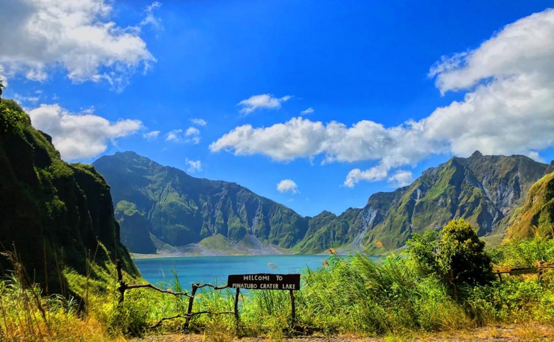
The Mount Pinatubo trek is a moderate day hike starting with a bumpy 4WD ride over lahar deposits, followed by a 45-minute hike across flat volcanic ash fields to the crater rim. The trail is mostly gentle but can be slippery where loose ash and sand dominate. The cold turquoise crater lake at the summit is the highlight, framed by jagged ash walls formed in the 1991 eruption. Expect crowds on weekends and holidays. Prepare for muddy conditions and bring waterproof shoes. Avoid the rainy season when jeep access is impossible.
How this peak formed
Pinatubo is an active stratovolcano known for its catastrophic 1991 eruption, which created a large caldera now filled by a cold crater lake. The caldera walls consist of consolidated volcanic ash and pumice deposits. The surrounding landscape is dominated by lahar flows – volcanic mudslides – that reshape the terrain seasonally. The crater lake’s turquoise color results from dissolved minerals and suspended volcanic particles. The volcano remains active but currently dormant with no recent eruptions.
What to see (5)
- ▸ View the cold, turquoise crater lake formed after the 1991 eruption
- ▸ Walk across extensive volcanic ash fields and lahar deposits
- ▸ Observe geological formations from the world’s second-largest 20th-century eruption
- ▸ Experience the stark contrast between barren caldera and surrounding forest
- ▸ Cross the final ash flat with panoramic views of the crater rim
Book a jeep tour starting from Capas or Botolan towns to avoid the busiest trailheads near Sta. Juliana.
Bring gaiters to prevent volcanic ash from entering your boots during the final ash field approach.
Mount Pulag – Sunrise Sea of Clouds from a High Alpine Grassland
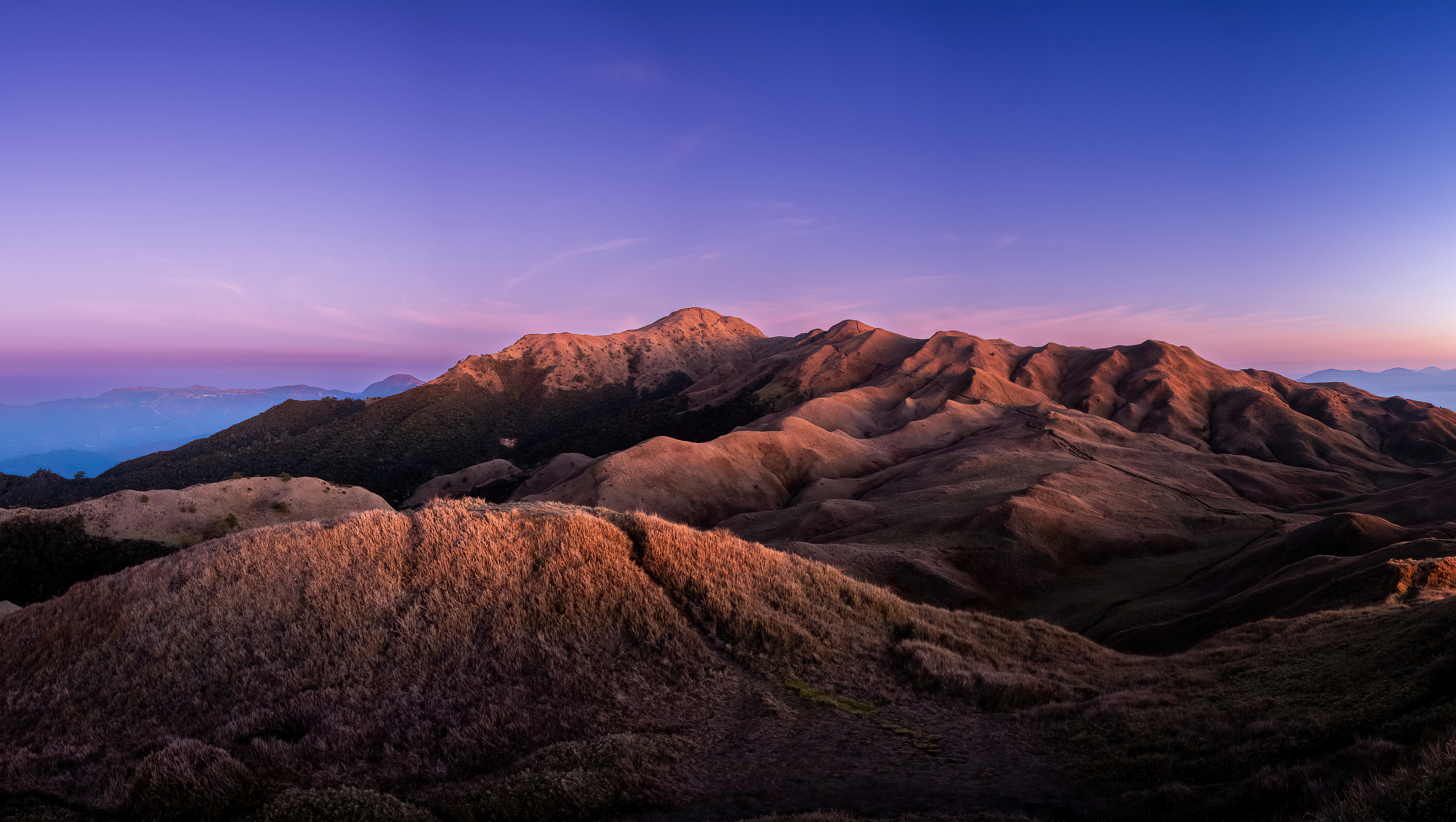
- Elevation: 2922 m
- Climb: moderate
- Best months: Dec, Jan, Feb, Mar, Apr
Mount Pulag offers a steep but manageable 2-day climb through mossy forest and alpine grasslands, gaining over 2,000 m elevation. The final ascent before dawn rewards climbers with a surreal sea-of-clouds inversion, where lower valleys disappear beneath a white blanket and neighboring peaks poke out. Trails are rocky with occasional muddy patches. The summit plateau is expansive, with cool air and strong winds. Expect crowded campsites during peak months. Arrive prepared for cold nights and variable weather. Skip the rainy season to secure clear views.
How this peak formed
Pulag is a non-volcanic peak formed by uplift and erosion within the Cordillera mountain range. Its summit features a broad plateau dominated by alpine grasslands and dwarf bamboo, shaped by persistent winds and cool temperatures. The soil is acidic and well-drained, supporting unique flora adapted to high altitude. The mountain’s geology consists mainly of sedimentary and metamorphic rocks uplifted by tectonic forces. Its distinct sea-of-clouds phenomenon results from temperature inversion layers common in the region’s climate.
What to see (5)
- ▸ Watch the sunrise over the famous sea-of-clouds inversion at summit
- ▸ Climb through mossy forest with endemic flora and giant ferns
- ▸ Traverse alpine grasslands with panoramic views of surrounding peaks
- ▸ Reach Ambangeg Camp for a rest stop with nearby water sources
- ▸ Spot rare bird species unique to high-elevation Cordillera ecosystems
Use the Ambangeg trailhead instead of the popular Tawangan route to avoid the largest crowds at campsites.
Carry a headlamp and warm layers for the pre-dawn summit push; temperatures can drop below freezing even in dry months.
Mount Mayon – Perfect Cone with Restricted Summit Access
Elevation 2462 mClimb hardBest months Nov, Dec, Jan, Feb, MarOpen +
Mount Mayon’s climb is frequently off-limits due to volcanic activity, making summit attempts risky and often prohibited. Instead, explore the base trails with moderate elevation gain on volcanic ash and rocky soil, offering close-up views of its symmetrical cone. The terrain is uneven but generally manageable for fit hikers. The surrounding landscape features agricultural fields and lava flows from recent eruptions. Photograph the volcano from Daraga church for the classic profile. Plan visits during stable periods and confirm access status before traveling.
How this peak formed
Mayon is an active stratovolcano built from layers of basaltic lava and ash, famed for its near-perfect conical shape. Its eruptions, most recently in 2018, produce fast-moving lava flows and pyroclastic material, shaping the steep slopes. The volcano’s base is covered in fertile volcanic soil, supporting dense vegetation and farms. Frequent fumarolic activity and ground deformation keep authorities cautious. The cone’s symmetry results from consistent eruption patterns and lava viscosity, making it one of the world’s most recognizable volcanoes.
What to see (5)
- ▸ Photograph the perfect cone from Daraga church viewpoint
- ▸ Hike base trails with views of recent lava flows and volcanic ash
- ▸ Explore Cagsawa ruins with volcanic history context
- ▸ Observe fumarolic vents on lower slopes during safe periods
- ▸ Visit nearby villages showcasing agricultural life on volcanic soil
Visit during weekdays when local tourists focus on the Daraga church viewpoint, avoiding weekend crowds at base trails.
Use early morning light for photography at Daraga church to capture Mayon’s cone with minimal haze.
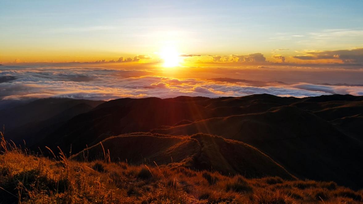
Mount Hibok-Hibok – Quick Active Volcano Hike on Camiguin Island
Elevation 1332 mClimb moderateBest months Nov, Dec, Jan, Feb, Mar, AprOpen +
Hibok-Hibok offers a steep but short 2-3 hour hike from forested trailhead to summit ridge with fumaroles and crater views. The trail is narrow and rocky, requiring steady footing, but manageable for most hikers with moderate fitness. The summit provides clear views of neighboring volcanic peaks and the sea. The climb is ideal for a half-day adventure combined with other island activities. Carry water and prepare for hot, humid conditions. The trail is quiet outside peak tourist seasons.
How this peak formed
Hibok-Hibok is an active stratovolcano on Camiguin Island, formed by layers of andesitic lava and pyroclastic deposits. Its fumarolic activity indicates ongoing subterranean heat and gas emissions. The volcano last erupted in the mid-20th century but remains closely monitored. The summit ridge exposes volcanic rock and sulfur vents, while the lower slopes support tropical forest. Its island setting exposes it to marine weather influences, shaping erosion patterns on the cone.
What to see (5)
- ▸ Reach summit ridge with views of volcanic fumaroles and steam vents
- ▸ Observe crater rim and volcanic rock formations close-up
- ▸ Enjoy panoramic views of Camiguin Island and surrounding sea
- ▸ Pass through dense tropical forest with endemic bird species
- ▸ Combine hike with visits to nearby Mantayupan Falls and hot springs
Hike midweek or early morning to enjoy quiet trails as the island’s tourist flow is low and dispersed.
Bring a lightweight rain jacket; sudden tropical showers are common even during dry months.
Mount Kanlaon – Challenging Active Volcano Traverse
Elevation 2465 mClimb hardBest months Feb, Mar, Apr, MayOpen +
Climbing Mount Kanlaon demands endurance on steep, often muddy trails with sharp elevation gains. The wedge-shaped crater emits constant sulfur fumes, adding a pungent edge to the air near the summit. Dense mossy forest cushions the lower slopes, giving way to barren volcanic rock closer to the rim. The route from Guintubdan to Mananawin spans multiple days, requiring steady pacing and solid conditioning. Summit views open over the volcanic cone’s sulfur vents, but caution is essential due to unpredictable volcanic activity. Check PHIVOLCS alerts rigorously before planning, as the mountain closes often and without warning.
How this peak formed
Kanlaon is the highest peak in central Philippines and an active stratovolcano with a wedge-shaped crater that constantly vents sulfur gases. It belongs to the Negros volcanic arc, formed by subduction of the Philippine Sea Plate beneath the Sunda Plate. The summit area features fresh volcanic rock and fumarolic vents releasing sulfur dioxide. The surrounding forest transitions from lowland dipterocarp to mossy montane flora near 6,000 feet / 1,830 m. Kanlaon’s activity level fluctuates, requiring ongoing monitoring for safe access.
What to see (5)
- ▸ Ascend through dense mossy forest along the Guintubdan Trail
- ▸ Cross the sulfur-venting crater rim with visible fumaroles
- ▸ Traverse the Mananawin trail offering rugged volcanic terrain
- ▸ Pause at the Mananawin campsite with views into the crater
- ▸ Spot endemic bird species in the montane moss forest zones
Kanlaon sees very few climbers during open periods; plan for the less popular Mananawin exit to avoid the rare peak-day crowd.
Carry a gas mask or bandana for sulfur fumes near the crater and schedule summit attempts only when PHIVOLCS Alert Level is at zero.
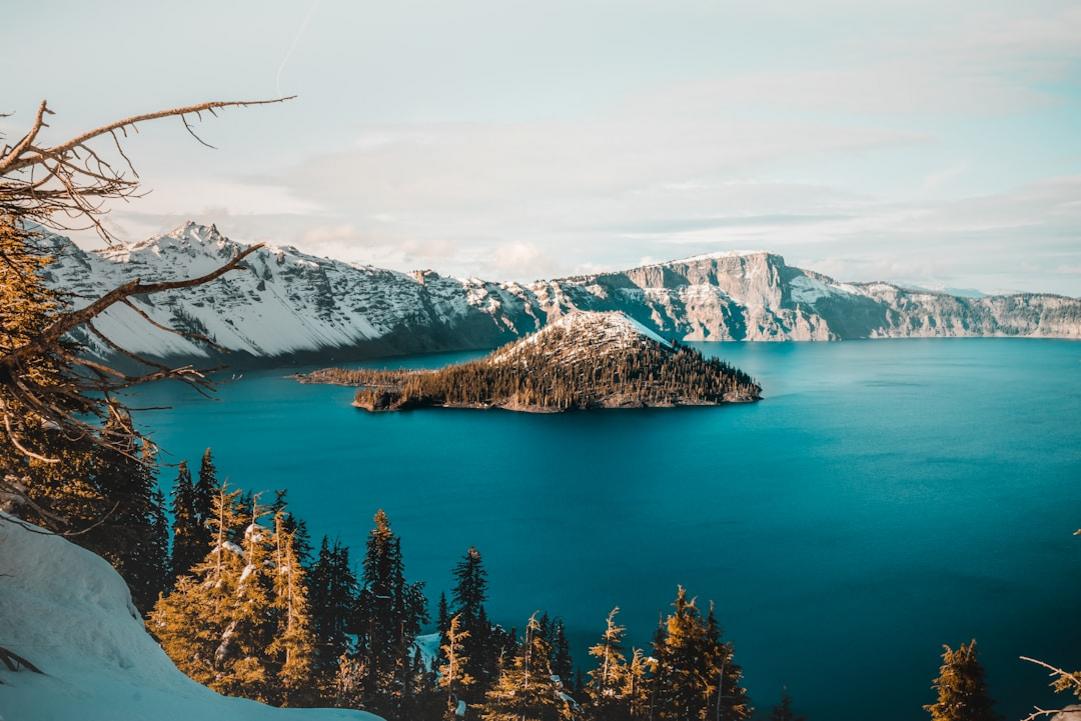
Mount Bulusan – Moderate Active Volcano with Lake Circuit
Elevation 1565 mClimb moderateBest months Feb, Mar, Apr, MayOpen +
Mount Bulusan offers a moderate day climb with steep but manageable gradients through mossy forest and volcanic soil. The trail ascends steadily to a crater rim, though summit access is often closed due to sudden phreatic eruptions. When the summit is off-limits, the Bulusan Lake circuit provides a safer alternative, winding through dense forest with occasional clearings. The climb’s physical effort is steady but not punishing, with humid conditions and soft volcanic ash underfoot. Summit views include the crater and surrounding forested slopes, but the lake circuit rewards with calm waters and wildlife spotting. Avoid summit attempts if DENR issues warnings; the volcano’s unpredictability demands caution.
How this peak formed
Bulusan is an active stratovolcano with a crater lake formed by volcanic activity and surrounded by mossy forest ecosystems. It sits within the Bicol Volcanic Chain, resulting from subduction along the Philippine Trench. The summit crater periodically releases steam and ash through phreatic eruptions, causing sudden trail closures. The surrounding rock is mostly andesite lava and volcanic ash deposits. The lake basin formed from past eruptions collects rainwater and supports a rich forest habitat.
What to see (5)
- ▸ Climb to the summit crater rim with sulfur venting views
- ▸ Walk the Bulusan Lake circuit through mossy forest trails
- ▸ Explore the Sabang Beach area with coastal volcanic scenery
- ▸ Observe endemic bird species in the dense forest canopy
- ▸ Visit the natural park’s ranger station for local flora exhibits
Avoid summit crowds by opting for the lake circuit trail, which remains quiet even during volcanic activity closures.
Bring waterproof gear for sudden tropical rains common in the afternoon and scout the lake circuit early to catch wildlife activity.
Mount Dulang-Dulang – Expert Trek Through Sacred Mossy Forest
Elevation 2938 mClimb expertBest months Feb, Mar, Apr, MayOpen +
Mount Dulang-Dulang demands expert-level fitness on steep, rugged trails through dense mossy forest starting around 6,500 feet / 1,980 m elevation. The climb is a multi-day trek with thick canopy cover from 6,500 feet / 1,980 m to the summit, so no views open at the top. The trail surface varies from soft soil to slippery moss and exposed roots, requiring careful footing. The air thins with altitude, making pacing critical on the steep ascents. The summit offers a solemn experience of the Talaandig people’s sacred land, not panoramic vistas. Expect damp, cool conditions and a slow, methodical pace. Only attempt with a Talaandig-affiliated guide and respect local rituals.
How this peak formed
Dulang-Dulang rises within the Mount Kitanglad Range, formed by tectonic uplift and erosion of sedimentary and igneous rocks. The mountain’s steep slopes are shaped by heavy rainfall and deep forest growth, creating thick moss layers and organic soils. The summit area features dense montane forest without clearings, preserving a unique ecosystem. Uplift continues subtly, maintaining sharp ridges and steep gradients. The geology supports rich biodiversity, with endemic flora adapted to high altitude mossy environments.
What to see (5)
- ▸ Experience the sacred panubad-tubad blessing ritual at trailhead
- ▸ Trek through thick mossy forest starting above 6,500 feet / 1,980 m
- ▸ Cross the steep, root-laden Upper Trail with slippery footing
- ▸ Camp at designated forest clearings with natural spring water
- ▸ Explore the diverse flora unique to the Mount Kitanglad Range
Dulang-Dulang sees very few climbers due to strict permits and expert difficulty; plan for the 2-4 month dry window to avoid trail closures.
Schedule the blessing ritual early to start fresh and bring trekking poles for slippery mossy sections on the upper slopes.
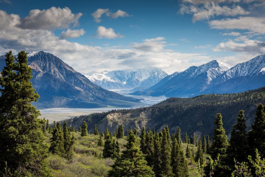
Mount Guiting-Guiting – Technical Knife-Edge Alpine Challenge
Elevation 2058 mClimb expertBest months Mar, Apr, MayOpen +
Mount Guiting-Guiting demands expert climbers with scrambling skills on its jagged ridges and knife-edge spines. The three-day expedition includes rope-assisted sections along narrow, exposed ridges known as the Knife Edge and Peak of Deception. Trails alternate between steep rock faces and dense forest below 3,000 feet / 914 m. The air is humid and thick with tropical flora scents at lower elevations, shifting to sharp alpine wind near the summit. The summit offers rugged, panoramic views but requires constant attention to footing. Only attempt with a licensed guide and solid scrambling experience; poor weather multiplies risks dramatically.
How this peak formed
Guiting-Guiting is a steep, jagged mountain formed by tectonic uplift and erosion of resistant volcanic and sedimentary rocks. The peak consists mainly of andesitic lava flows and volcanic breccias, sculpted into sharp ridges by wind and rain. Located on Sibuyan Island, the mountain’s geology creates narrow knife-edge ridges with unstable scree slopes. Erosion continues to shape the peak’s spines, producing technical climbing challenges. The surrounding forest transitions from lowland dipterocarp to montane mossy forest near 4,000 feet / 1,220 m elevation.
What to see (5)
- ▸ Navigate the Knife Edge ridge with narrow, exposed scrambling sections
- ▸ Conquer the Peak of Deception with steep rock faces and sharp drops
- ▸ Camp at Upper Camp surrounded by mossy forest
- ▸ Enjoy panoramic views over Sibuyan Island from the summit ridge
- ▸ Traverse the lower montane forest with endemic bird sightings
Guiting-Guiting sees very low traffic due to difficulty; climb during the dry months of March to May for safer conditions and fewer permit conflicts.
Bring climbing gloves and helmet for knife-edge sections and start before 04:00 to avoid afternoon thunderstorms common on Sibuyan Island.
Best Time to Climb Philippines Volcanoes and Mountains
March to May offers the best climbing conditions for most Philippine peaks. Avoid the rainy season, especially on Mount Pinatubo where jeep access fails. Mayon’s activity can close the summit unpredictably.
The dry season from November to May shapes climbing windows across the Philippines. Mount Apo and Mount Kanlaon are best climbed in March to May for stable weather and clear views. Mount Pinatubo’s crater lake is accessible from November through April, but the jeep trail becomes impassable in heavy rains. The wet season, from June to October, brings frequent storms and slippery trails, making climbs like Mount Pulag and Mount Bulusan risky or clouded out. The coldest months, December to February, bring clearer skies but can cause cold snaps on higher peaks like Mount Apo, requiring warm gear. Planning climbs within these windows maximizes safety and summit visibility.
Lower volcanoes like Mount Pinatubo and Mount Hibok-Hibok allow year-round access when trails are dry, but jeep access to Pinatubo fails in heavy rain. High-elevation climbs such as Mount Apo (2,954 m) and Mount Kanlaon (2,465 m) demand a narrow March – May window to avoid unstable weather and cloud cover above 2,300 meters. Mount Pulag’s 2,922 m summit is accessible mainly in dry months, with frequent cloud cover limiting views outside this. Timing climbs by elevation is essential to avoid dangerous weather shifts and maximize summit conditions.
Staying Safe on Philippine Volcanoes and Mountains
Philippine peaks combine tropical weather with active volcanism and steep terrain. Safety depends on monitoring volcanic activity, securing permits, hiring local guides, and preparing for rapid weather changes. Each volcano demands specific precautions due to ongoing fumaroles or eruption risks.
- Check PHIVOLCS alerts before climbing Mount Kanlaon. The volcano closes frequently when Alert Level rises above 1 due to sulfur venting and possible eruptions. Avoid summit attempts during closures.
- Mount Pinatubo’s jeep trail becomes impassable in heavy rain. Confirm jeep availability before arrival to avoid being stranded on the lahar fields. The crater rim is unstable and slippery after rain.
- Mount Apo’s steep, technical trails above 2,300 meters are prone to cloud cover and slippery conditions. Use a certified guide from Davao City and avoid attempting the climb during the rainy season when trails become treacherous.
- Mount Bulusan’s summit access closes unpredictably during phreatic eruptions. When closed, stick to the lake circuit trail to avoid sudden volcanic hazards and unstable crater rims.
- Mount Hibok-Hibok’s short hike includes fumarolic zones near the summit. Stay on marked trails to avoid unstable ground and toxic steam vents, especially after recent volcanic activity.
- Mount Mayon’s summit is often off-limits due to frequent eruptions. Do not attempt to climb the cone; instead, hike the base trails and photograph from designated safe areas like Cagsawa village.
Preparing for the Philippines’ Volcanic Summits
Philippine volcanoes and high peaks demand specific preparation due to steep volcanic terrain, unpredictable weather, and permit requirements. Each climb varies in technical difficulty and access rules, so conditioning, local regulations, and volcanic activity checks are critical. Proper preparation ensures safety and success on peaks like Mount Apo’s active crater or the technical ridges of Mount Guiting-Guiting.
Start Endurance Training Months Ahead
Build cardio and leg strength focused on steep, uneven volcanic trails like Mount Apo’s 1,900 m elevation gain and Mount Kanlaon’s slippery slopes. Include hill repeats and weighted hikes to simulate trail conditions.
Research Permit and Guide Requirements
Confirm mandatory permits and guide bookings for peaks like Mount Apo, Mount Kanlaon, and Mount Guiting-Guiting. Contact accredited agencies in Davao City or local DENR offices well in advance.
Plan Acclimatization Strategy
Schedule gradual altitude exposure for climbs over 2,900 m such as Mount Apo and Mount Pulag. Consider arriving early to Baguio or Davao City to adjust before summit attempts.
Check Volcanic Activity and Weather
Monitor PHIVOLCS alerts for active volcanoes like Mount Mayon and Mount Kanlaon. Avoid climbs during elevated alert levels or rainy season months when trails become dangerous or access is restricted.
Assemble Specialized Gear
Pack sturdy hiking boots with good traction for volcanic ash and rocky terrain. Include gaiters for Mount Pinatubo’s ash fields and a gas mask or bandana for sulfur fumes near fumaroles on Mount Apo and Kanlaon.
Confirm Local Transport and Trail Access
Arrange 4×4 rides or jeepneys to trailheads such as Davao City for Mount Apo or Camiguin for Mount Hibok-Hibok. Verify road conditions and parking availability before arrival.
Prepare Emergency Contacts and Plans
Save local ranger stations, DENR offices, and accredited guide contacts for each peak. Understand evacuation routes and emergency procedures, especially for active volcanoes like Bulusan and Kanlaon.
Pace Yourself on the Mountain
Start early, maintain steady effort on steep volcanic slopes, and watch for altitude effects on peaks like Mount Apo and Mount Pulag. Stay hydrated and respect weather changes to avoid risky summit pushes.
Choosing the Right Philippine Peak for Your Climb
Mount Apo demands a hard, technical 2-3 day climb with 1,900+ meters elevation gain and volcanic crater exposure. It suits climbers prepared for steep, muddy trails and high-altitude volcanic conditions.
Mount Pulag offers a moderate 2-day climb with a famous sea-of-clouds sunrise. Its alpine grasslands and accessible trailheads make it ideal for those wanting a spectacular dawn summit without extreme technical difficulty.
Mount Pinatubo’s moderate day trek from Manila features a unique crater lake and volcanic ash fields. It fits travelers wanting a volcanic summit experience within a single day trip and manageable effort.
Mount Guiting-Guiting requires expert scrambling skills on narrow ridges with rope-assisted sections. It suits climbers seeking the country’s most challenging alpine terrain and technical exposure.
Mount Hibok-Hibok is a short, steep day climb on Camiguin Island with volcanic fumaroles and crater views. It’s perfect for travelers combining island activities with a quick volcanic summit.
Philippine Volcanoes and Mountain Climbing FAQ
1Are guides mandatory for climbing Mount Apo?
Yes, guides and permits are mandatory for Mount Apo due to its technical trails and active volcanic crater. Booking through accredited agencies in Davao City is essential. This ensures safety and compliance with local regulations.
2What is the best season to climb Mount Hibok-Hibok?
The best months for Mount Hibok-Hibok are November through April when weather is drier and trail conditions are stable. Avoid the rainy season to prevent slippery volcanic terrain and sudden tropical showers.
3Is water available on the Mount Kanlaon multi-day trek?
Water sources are scarce above 4,000 feet / 1,220 m on Mount Kanlaon, so carry sufficient supplies for the entire 3-day trek. Ranger stations exist only at trailheads; plan hydration carefully to avoid dehydration on steep volcanic slopes.
4Can drones be flown on Mount Pulag trails?
Drone use is restricted within Mount Pulag National Park to protect wildlife and visitor privacy. Permits may be required and are rarely granted. It’s safer to leave drones at home or use them only in designated areas outside the park.
5How difficult is the Mount Bulusan summit climb compared to other volcanoes?
Mount Bulusan’s summit climb is moderate with steep sections and soft volcanic ash, less technical than Mount Apo or Kanlaon. However, frequent sudden eruptions mean summit access can close without warning; the lake circuit is a safer alternative.
6What permits are needed for Mount Dulang-Dulang?
Mount Dulang-Dulang requires strict permits and a Talaandig-affiliated guide due to its sacred status. Booking through local community guides in Lantapan is mandatory, and the blessing ritual must be observed before starting the climb.
7Is it worth climbing Mount Mayon’s summit when open?
Summit access to Mount Mayon is rarely allowed due to active eruptions. Even when open, the climb is hard and risky. It’s better to hike the base trails for safe views of the perfect cone and avoid summit attempts.
8What is the realistic time to complete the Mount Guiting-Guiting climb?
Mount Guiting-Guiting requires approximately 3 days for the out-and-back expedition, including rope-assisted scrambling on exposed ridges. Starting before 4:00 AM is recommended to avoid afternoon storms and complete technical sections safely.
Some links on this page are affiliate links. We may earn a small commission at no extra cost to you when you book through them.