


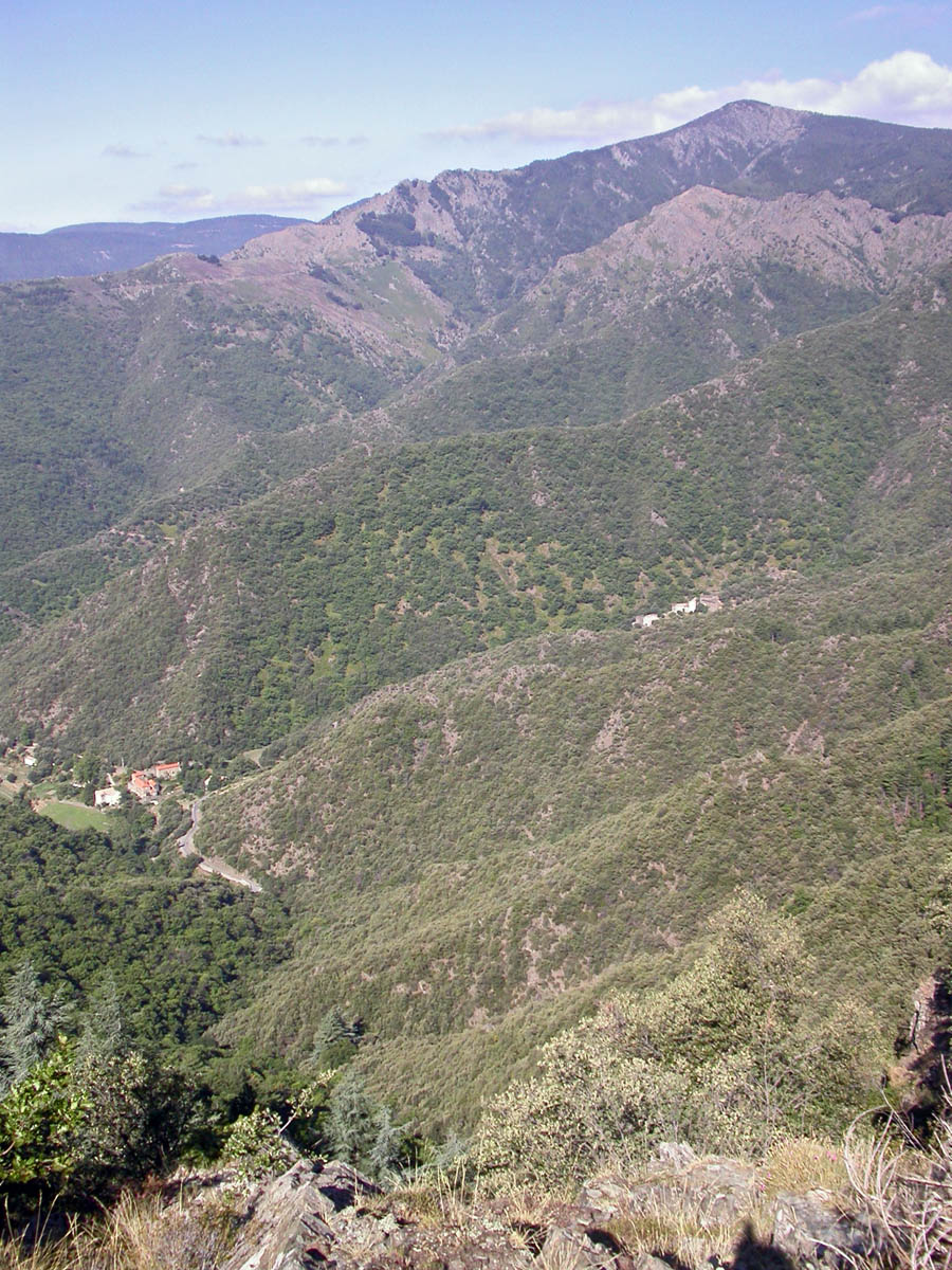
Standing atop Mont Aigoual reveals a patchwork of rugged peaks and rolling valleys stretching to the horizon.
This hike takes you to the highest point in the Gard department, within the Cevennes National Park. The trail winds through pine forests and rocky outcrops, offering a chance to see the landscape from above and experience the park’s raw terrain. It is a half-day effort that rewards with expansive views and a sense of accomplishment.
Expect to start early to beat the crowds and avoid afternoon weather shifts. The ascent takes roughly four hours round-trip, with a steady climb that demands moderate fitness. The summit’s altitude of 1567 meters means cool air and potential wind, so dress accordingly and carry water. The effort is justified by the sweeping vistas and the chance to stand on France‘s highest point in the region.
What to expect
- See the forested slopes of the Cevennes stretch out below as the trail climbs through pine and oak.
- Feel the rocky terrain underfoot as the path narrows near the summit, with exposed sections offering panoramic views.
- Experience the cool, crisp air at the top, with a breeze that shifts as clouds roll across the peaks.
- Observe the weather changing quickly, with clear skies giving way to overcast conditions in the afternoon.
- Recall the quiet of the mountain, broken only by the wind and distant bird calls, after a challenging ascent.
Climbing Mont Aigoual is worth it if you seek a physically rewarding view and are prepared for altitude and weather shifts.
Core stopThis hike is best for those with moderate fitness who want a true mountain experience. The trail’s steady climb and exposed sections demand effort, but the 1567-meter summit offers unmatched views of the Cevennes landscape. Crowds are minimal early in the morning, and weather can turn quickly, so start at first light and carry layered clothing. The mountain’s prominence and its role as a weather station add a layer of historical significance, making the effort worthwhile for landscape lovers and active travelers willing to plan ahead.
Quick facts about the Mont Aigoual hike
| Cost | Free |
| Open season | All year |
| Time needed | 4 hours round-trip |
| Getting there | Start from the parking lot near the trailhead, accessible by car from Pont Du Gard |
| Best timing | Early morning for clear views and fewer hikers |
| Difficulty | Moderate with exposed sections and altitude |
Climb Mont Aigoual for a Clear View of the Cevennes
Start your ascent early in the morning, ideally around 8 AM, to avoid the midday crowds and catch the mountain’s crisp air. Park at the visitor center, which charges a modest entrance fee, and prepare for a 45-minute drive along winding roads that lead up to the trailhead. Once on the trail, follow the marked path that ascends steadily through sparse pine and oak trees, with occasional switchbacks that test your stamina.

Midway, you’ll reach a small clearing where the terrain levels out; here, the trail opens to a broad, rocky plateau. This is the moment to pause and take in the view: the summit of Mont Aigoual looms directly ahead, with its weather station and observatory visible in the distance. Continue upward, passing a weather station that has operated since the early 20th century, and reach the summit after about 30 minutes of steady walking. At the top, stand on the concrete platform and look out over the rugged peaks of the Cevennes, with the Massif Central stretching behind. If the weather is clear, you can see as far as the Mediterranean coast, 70 miles / 115 km away. Spend a few minutes here, then descend the same way or take a different trail that loops around the mountain for a more challenging route. Remember, the summit can be windy and cold even in summer, so dress accordingly and avoid the peak during storms or high winds.
Key Spots on Mont Aigoual
Trailhead at the Visitor Center
The starting point for your hike, where you pay the entrance fee and get trail maps. The parking lot fills quickly on weekends, so arrive early if possible.
TipPark on the east side of the lot to avoid the busiest spots and get a quick start on the trail.
Midway Clearing with Viewpoint
A flat, open area about halfway up, offering a panoramic view of the surrounding valleys and peaks. It’s a good spot to rest and take photos.
TipUse the large boulder on the left side of the clearing to set up your camera for a wide-angle shot with the massif in the background.
Weather Station at the Summit
The historic weather station built in the 1920s, still operational and used for climate monitoring. It’s a symbol of the mountain’s meteorological importance.
TipAsk the staff if you can peek inside the station for a quick look at the old instruments-visitors are sometimes allowed during off-peak hours.
Concrete Viewing Platform
The main spot for taking in the 360-degree views, with safety rails and informational plaques about the landscape.
TipVisit early in the morning or late in the afternoon when the light hits the peaks at an angle, creating sharper shadows and better photos.
Loop Trail around the Mountain
A more challenging route that circles the summit, offering different perspectives of the massif and the chance to see wildlife like chamois or marmots.
TipCarry a detailed map from the visitor center, as the loop trail is less well-marked and can be confusing in poor visibility.
Essential Gear for Mont Aigoual
- Windbreaker or waterproof jacket
The summit can be windy and unpredictable weather at 1567 meters elevation, especially in the afternoon. - Sturdy hiking shoes with good grip
The trail to Mont Aigoual involves uneven terrain and loose gravel, requiring reliable footing. - Sun protection (sunscreen, sunglasses)
High altitude exposure means stronger UV rays, even on cloudy days. - Map or GPS device
The trail is well-marked but remote sections can be confusing, especially in fog or low visibility. - Cash in euros or euros equivalent
The entrance fee and parking are cash-only, and no nearby ATM exists at the site.

Getting to Mont Aigoual from Pont Du Gard
The drive covers approximately 70 miles / 115 km and takes about 2 hours, depending on traffic and road conditions.
- Car
Rent a small car with good clearance; the final approach involves narrow, winding mountain roads with limited passing spots. - Bus + Taxi
Take a regional bus to the nearby town of Valleraugue, then hire a local taxi for the last 10 miles / 16 km; confirm taxi availability beforehand. - Bike
For experienced cyclists, the route from Pont Du Gard is hilly but feasible; start early to avoid afternoon wind.
Risks and Precautions at Mont Aigoual
- Sudden weather changes causing fog or rain
Check weather forecasts before departure and carry extra clothing; avoid summit in poor visibility. - Narrow, winding roads with limited guardrails
Drive slowly and stay alert; do not attempt the drive in heavy rain or snow. - Limited cell service at the summit
Download offline maps and inform someone of your plans; carry a physical map. - High altitude fatigue or dizziness
Start the hike early, pace yourself, and stay hydrated; avoid pushing beyond your limits.
Expert Hack: Timing the Visit for Clear Views
Arrive early in the morning or late in the afternoon; mid-day clouds and wind often obscure the view, and parking fills quickly by late morning.
Frequently Asked Questions About Mont Aigoual
1What is the best time of day to start the hike on Mont Aigoual?
Begin early in the morning around sunrise to avoid afternoon fog and enjoy clearer views. Mid-morning offers stable weather conditions, but check local forecasts before starting.
2How does weather affect the visibility from Mont Aigoual?
Cloud cover can obscure the summit views, especially in the afternoon or during high humidity. Clear days with low fog provide the best visibility, so plan your visit on days with stable weather forecasts.
3Are there any seasonal closures or restrictions on Mont Aigoual?
Access is generally open year-round, but snow and ice can close the trail in winter. Check current conditions before visiting, especially if planning a winter hike, and consider postponing if heavy snow is forecasted.
4What should I do if the weather turns bad during my hike?
If fog or rain develops, descend immediately to avoid disorientation or slipping. Carry a GPS device or map, and consider turning back if visibility drops below 50 feet / 15 m.
5Is it feasible to hike Mont Aigoual solo for someone with average fitness?
Yes, the trail is well-marked and manageable for hikers with moderate fitness. However, always inform someone of your plans and carry essentials like water, a map, and a fully charged phone.
6Are there any restrictions on photography or drone use on Mont Aigoual?
Photography is allowed everywhere, but drones are prohibited within the Cevennes National Park boundaries. Respect local regulations to avoid fines or disturbance to wildlife.
Next Step After Reaching the Summit
After enjoying the views from Mont Aigoual, descend and head towards the nearby village of Saint-Jean-du-Gard. It offers local cafes and a chance to explore regional history, making it a good spot to relax and refuel before continuing your journey.
Hero image: No machine-readable author provided. RobinL~commonswiki assumed (based on copyright cla… (CC BY-SA 2.5), via Wikimedia Commons. Other photos via Unsplash and Wikimedia Commons.
Some links on this page are affiliate links. We may earn a small commission at no extra cost to you when you book through them.