


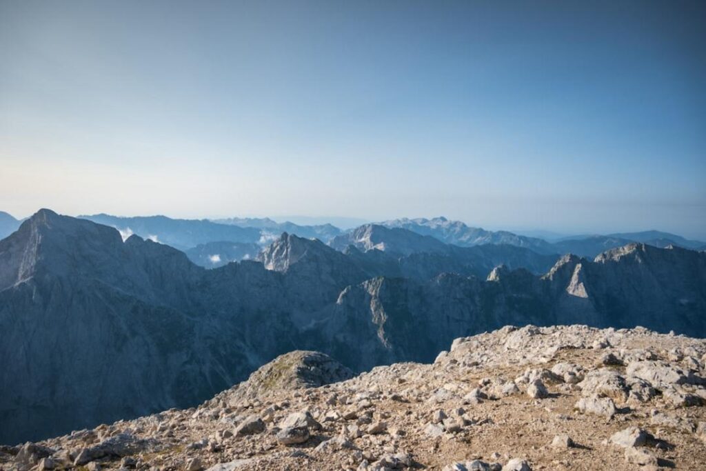
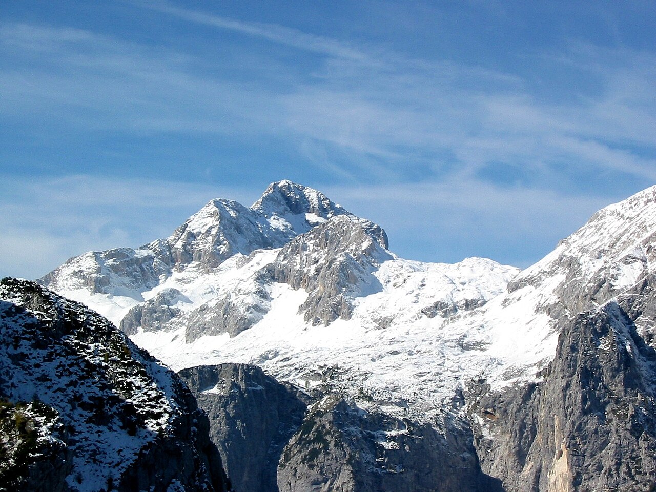
Tanzania‘s mountains rise dramatically from the plains, showcasing a mix of volcanic formations and rugged highlands. The skyline features the iconic silhouette of Mount Kilimanjaro, Africa’s highest peak, alongside the jagged ridges of Mount Meru and the unique Ol Doinyo Lengai. Each peak offers distinct challenges and rewards, making this region a prime destination for climbers and trekkers alike.
The 10 peaks in Tanzania range from the challenging ascent of Kilimanjaro to the more accessible Mount Hanang. Climbers can tackle the technical routes of Mount Meru or enjoy the scenic views from Shagayu Peak. If you seek high-altitude adventures, this guide is for you; if you prefer leisurely hikes, stop here.
Key takeaways
- Climb Mount Kilimanjaro via Lemosho for the best acclimatization and summit success rate of over 85%.
- Opt for Mount Meru as a pre-Kilimanjaro acclimatization climb; its technical challenges prepare you for Kili’s altitude.
- Choose Ol Doinyo Lengai for an active volcanic experience, but only if you’re ready for a brutal overnight scramble.
- Skip the 5-day Marangu route on Kilimanjaro; it has the lowest summit success rate due to insufficient acclimatization.
- Plan to summit Uhuru Peak early in the morning to avoid extreme cold and high altitude risks.
- Mount Hanang is the best budget-friendly climb, requiring only a local guide and no park fees.
- Visit during the dry months of June to September for optimal climbing conditions on all peaks.
The peaks at a glance
| Peak | Type | Region | Effort | Why it is on the list |
|---|---|---|---|---|
| Mount Kilimanjaro | Dormant stratovolcano | Kilimanjaro Region | Hard 5-9 day trek | Summit attempt at Uhuru Peak with iconic wooden marker |
| Mount Meru | Active stratovolcano | Arusha National Park | Hard 3-4 day trek | Technical scramble on knife-edge ridge to Socialist Peak |
| Ol Doinyo Lengai | Active natrocarbonatite volcano | Gregory Rift | Hard overnight scramble | Unique cooler lava and active crater viewing |
| Uhuru Peak | Summit of Kilimanjaro | Kilimanjaro Region | Hard summit night trek | Highest point in Africa with glacier views |
| Mawenzi | Technical alpine peak | Kilimanjaro Region | Expert technical climb | Requires rock climbing skills and special permits |
| Mount Hanang | Extinct volcano | Manyara Region | Moderate day hike | Affordable climb with local guide, no park fees |
| Mount Rungwe | Dormant volcano | Southern Highlands | Moderate long day hike | Crater lake at the summit with endemic wildlife |
| Shagayu Peak (Western Usambara) | Forested viewpoint hill | Usambara Mountains | Easy 3-4 day trek | Village-to-village trek with homestays and cool climate |
| Lupanga Peak (Uluguru) | Forested mountain | Uluguru Mountains | Moderate long day hike | High endemism and scenic views from the summit |
| Loolmalasin | Extinct volcano | Ngorongoro Highlands | Moderate special permit climb | Unmatched views into Empakaai Crater from the summit |
Where the peaks are
Every peak in depth
Prefer a guide for the harder climbs? Local operators run permitted, guided trips on the peaks below.
Mount Kilimanjaro – The 8-Day Route Wins Summit Odds
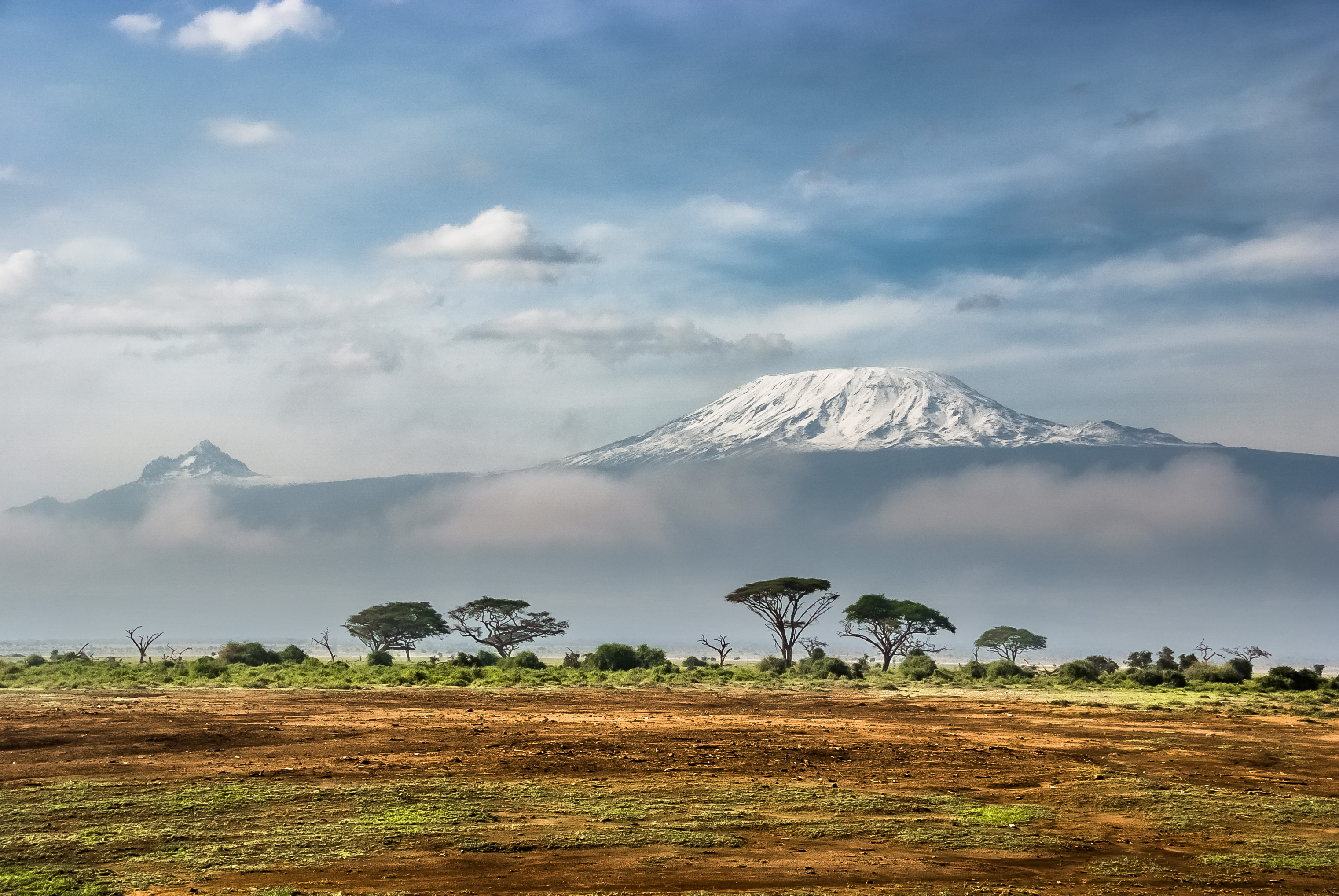
- Elevation: 5895 m
- Climb: hard
- Volcano: last erupted ~360,000 years ago (Kibo cone dormant; Mawenzi extinct)
- Best months: Jan, Feb, Jun, Jul, Aug, Sep
Climbing Kilimanjaro means pacing through five distinct climate zones, from rainforest to alpine desert, over 5 to 9 days. The final summit night starts around midnight from Barafu Camp, pushing through loose scree in near-freezing temperatures for 6 to 7 hours. Expect crowded trails on popular routes like Marangu and Machame, especially near the summit. The Barranco Wall scramble on Machame and Lemosho routes demands careful footing but rewards with a real climbing challenge. Skip the 5-day Marangu route unless budget forces it; it cuts acclimatization and slashes summit success rates.
How this peak formed
Kilimanjaro is a dormant stratovolcano complex with three cones: Kibo, Mawenzi, and Shira. Kibo’s summit crater still emits sulfur gases, and the Furtwängler Glacier inside is rapidly shrinking. The mountain formed along the East African Rift about 2.5 million years ago. Climbers cross volcanic rock and loose scree, passing through five ecological zones, including a disappearing ice cap that once covered much of the summit.
What to see (5)
- ▸ Summit sunrise over Mawenzi from Stella Point after a midnight start
- ▸ Cross the Shira Plateau’s high-altitude desert on western routes
- ▸ Scramble the Barranco Wall, the only Class 3 section on Machame and Lemosho
- ▸ View the rapidly retreating Furtwängler Glacier at the crater rim
- ▸ Spot black-and-white colobus monkeys in the rainforest zone early in the trek
Avoid the Marangu route’s crowded huts by choosing Lemosho or Northern Circuit, which spread trekkers over longer distances and fewer bottlenecks.
Carry trekking poles for the Barranco Wall scramble to reduce knee strain and improve balance on loose rock.
Mount Meru – The Best Kilimanjaro Acclimatizer
- Elevation: 4566 m
- Climb: hard
- Volcano: last erupted 1910
- Best months: Jun, Jul, Aug, Sep, Oct, Jan, Feb
Mount Meru demands a steep 3-4 day climb with technical scrambling on a knife-edge ridge near the summit. The route passes through dense montane forest with real wildlife like buffalo and elephants, requiring an armed ranger escort. Summit night starts around midnight from Saddle Hut at 11,500 ft / 3,510 m, with a final 90-minute scramble to Socialist Peak. The descent is tough on knees due to scree. Meru’s views of Kilimanjaro and the Maasai Steppe at dawn are arguably better than Kilimanjaro’s own summit. Skip Meru if not climbing Kilimanjaro next; it’s costly and technical for a standalone peak.
How this peak formed
Meru is an active stratovolcano with a horseshoe-shaped crater formed by a massive flank collapse 250,000 years ago. Its last eruption was in 1910. The trail ascends volcanic soils through montane forest, heath, and alpine zones, ending on a knife-edge rim of volcanic rock requiring hand-and-foot scrambling. The Ash Cone inside the crater is a perfect cinder cone formed during the 1910 eruption.
What to see (5)
- ▸ Watch Kilimanjaro silhouette at dawn from Socialist Peak
- ▸ Explore the Ash Cone cinder cone inside Meru’s crater
- ▸ Spot black-and-white colobus monkeys and buffalo in montane forest
- ▸ Enjoy sunset views from Saddle Hut at 11,500 ft / 3,510 m
- ▸ Photograph Mount Meru from Momela Lakes in Arusha National Park
Meru stays quiet year-round except for a slight increase June to September; summit night is the only real bottleneck but remains manageable.
Use gaiters and trekking poles on scree descent to protect knees and prevent sliding on loose volcanic rock.
Ol Doinyo Lengai – The Brutal Overnight Volcano Scramble
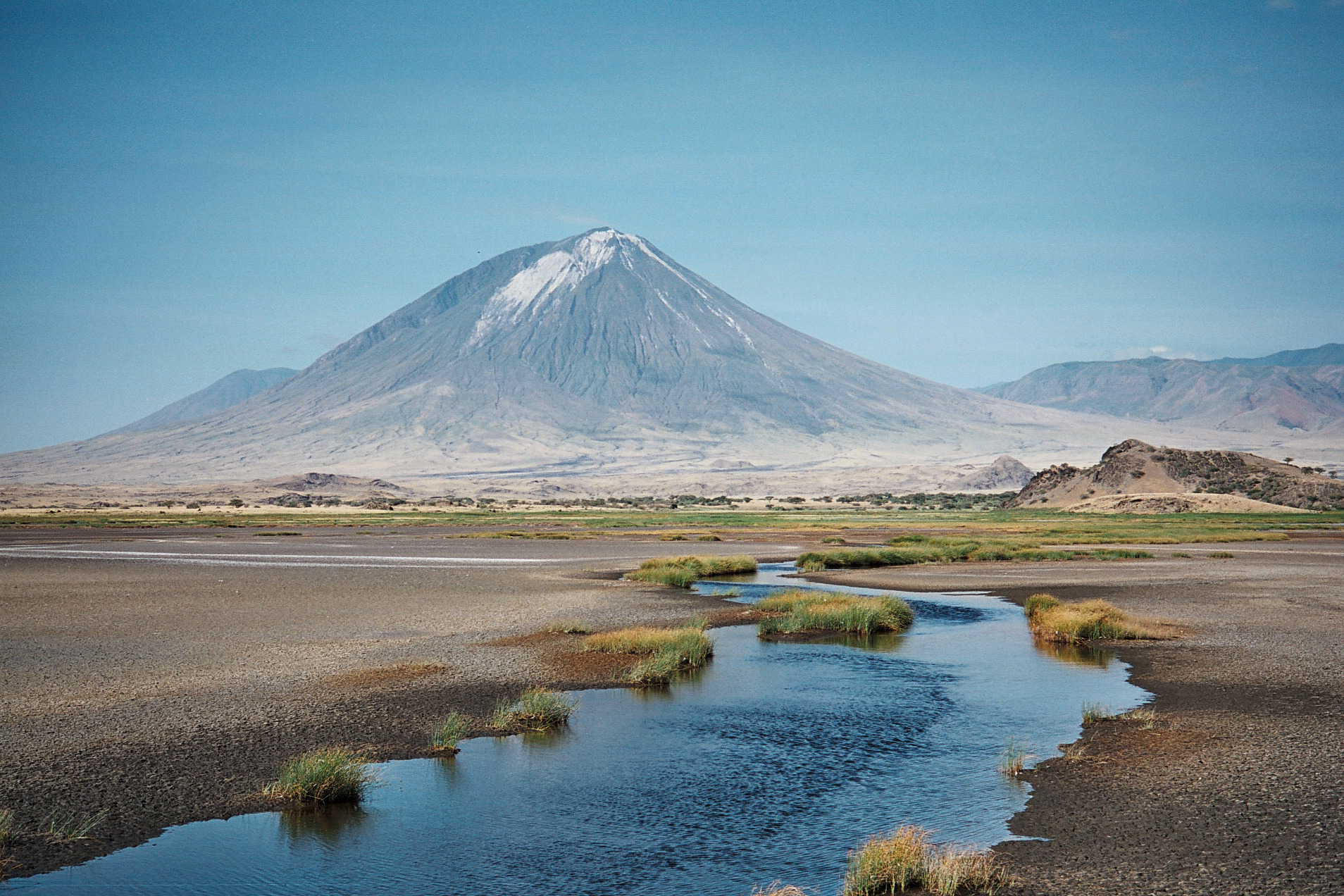
- Elevation: 2962 m
- Climb: hard
- Volcano: last erupted 2013 (ongoing minor activity)
- Best months: Jun, Jul, Aug, Sep, Jan, Feb
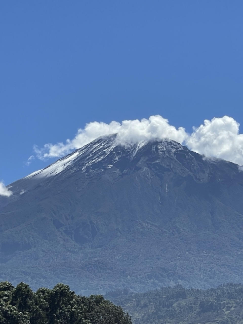
Ol Doinyo Lengai is a punishing overnight climb starting at midnight from Engaresero village, gaining 5,200 ft / 1,580 m over loose volcanic scree in 5-6 hours. The trail offers no shade or water, and the descent is harder than the ascent, with knees and quads taking a beating on scree slides. The summit crater occasionally shows active lava flows visible at night during eruptions. The climb is technically straightforward but physically brutal and requires a mandatory Maasai guide. Skip the climb in the wet season when scree turns to mud and footing becomes dangerous.
How this peak formed
Ol Doinyo Lengai is the world’s only active natrocarbonatite volcano, erupting cooler lava at around 510°C that weathers white, giving the summit a snow-like appearance. Its last eruption was in 2013 with ongoing minor activity. The volcano formed in the Gregory Rift south of Lake Natron and features a deep summit pit created by explosive eruptions in 2007-08. The surrounding landscape is volcanic ash and loose scree with no vegetation.
What to see (5)
- ▸ Summit sunrise over the active crater with occasional lava glow
- ▸ View the white-weathered natrocarbonatite lava deposits at the summit
- ▸ Experience the vast Lake Natron flamingo breeding flats below
- ▸ Hike to Engaresero waterfalls in a basalt canyon as a side trip
- ▸ Visit a genuine Maasai boma village near Engaresero for cultural insight
Lengai remains quiet year-round except for a small peak during dry season months; no alternative routes reduce crowding risk.
Wear old shoes you can sacrifice on scree descent and carry trekking poles to control slides and protect knees.
Uhuru Peak – Push Past False Summits to Africa’s Roof
Elevation 5895 mClimb hardBest months Jan, Feb, Jun, Jul, Aug, SepOpen +
Reaching Uhuru Peak requires a brutal midnight start from Barafu or Kibo Hut, climbing loose scree for 6-7 hours to Stella or Gilman’s Point, then pushing another 45-60 minutes along the crater rim at nearly 19,300 ft / 5,880 m. Many climbers stop at Stella or Gilman’s Point, mistakenly thinking they’ve summited; the final stretch is physically demanding but essential. Expect extreme cold, wind chill down to -40°C, and oxygen at half sea-level pressure. Limit summit time to 15-20 minutes to reduce altitude sickness risk. Descend quickly to avoid complications.
How this peak formed
Uhuru Peak sits on Kibo, Kilimanjaro’s dormant central cone, atop the 1.9 km-wide Reusch Crater rim. The summit ridge is flat and glacier-fringed, with the shrinking Furtwängler Glacier nearby. Kibo’s fumaroles emit sulfur gases, indicating residual volcanic activity despite dormancy. The summit’s volcanic rock and ice cap are relics of eruptions dating back hundreds of thousands of years, shaped by East African Rift tectonics.
What to see (5)
- ▸ Photograph the wooden ‘Africa’s Highest Point’ summit marker
- ▸ Walk to the edge of the Furtwängler Glacier remnants
- ▸ Watch sunrise over Mawenzi’s jagged eastern cone
- ▸ View into the Reusch Crater and the inner Ash Pit fumaroles
- ▸ Reach Stella Point sunrise marker as a legitimate high-altitude turnaround
Summit crowds peak August-September; avoid bottlenecks by choosing longer, less popular routes like Lemosho or Northern Circuit.
Carry extra batteries for headlamps; cold summit temperatures drain lithium-ion power rapidly.
Mawenzi – Tanzania’s Technical Alpine Challenge
Elevation 5149 mClimb expertBest months Jan, Feb, Jun, Jul, Aug, SepOpen +
Mawenzi is not a trek but a technical alpine climb requiring rock climbing skills and special permits. Its jagged pinnacles demand Class 5 climbing on loose, exposed rock. Almost no commercial operators offer Mawenzi ascents; it’s reserved for experienced alpinists. The summit offers dramatic views but is inaccessible to trekkers. For non-climbers, the best experience is admiring Mawenzi’s rugged profile from Kibo Saddle during a Kilimanjaro trek. Attempt Mawenzi only with proper gear and training.
How this peak formed
Mawenzi is Kilimanjaro’s extinct eastern volcanic cone, formed over 500,000 years ago. Its jagged peaks are composed of volcanic rock heavily eroded and fractured, creating steep faces and pinnacles. Unlike Kibo, Mawenzi shows no fumarolic activity and is geologically dormant. The peak’s rugged terrain reflects intense alpine erosion and volcanic collapse processes.
What to see (5)
- ▸ Climb Hans Meyer Peak, Mawenzi’s highest pinnacle
- ▸ Traverse exposed ridges with Class 5 rock climbing sections
- ▸ View Mawenzi’s jagged spires from Kibo Saddle on Kilimanjaro trek
- ▸ Observe extensive volcanic rock fracturing and alpine erosion features
- ▸ Experience remote alpine environment far from Kilimanjaro’s main routes
Mawenzi sees almost no climbers except expert alpinists; the peak is quiet year-round with no crowd issues.
View Mawenzi from Kibo Saddle during Kilimanjaro ascent for dramatic photos without technical risk.
Mount Hanang – Tanzania’s Best Off-Circuit Volcano Climb
Elevation 3417 mClimb moderateBest months Jun, Jul, Aug, Sep, Jan, FebOpen +
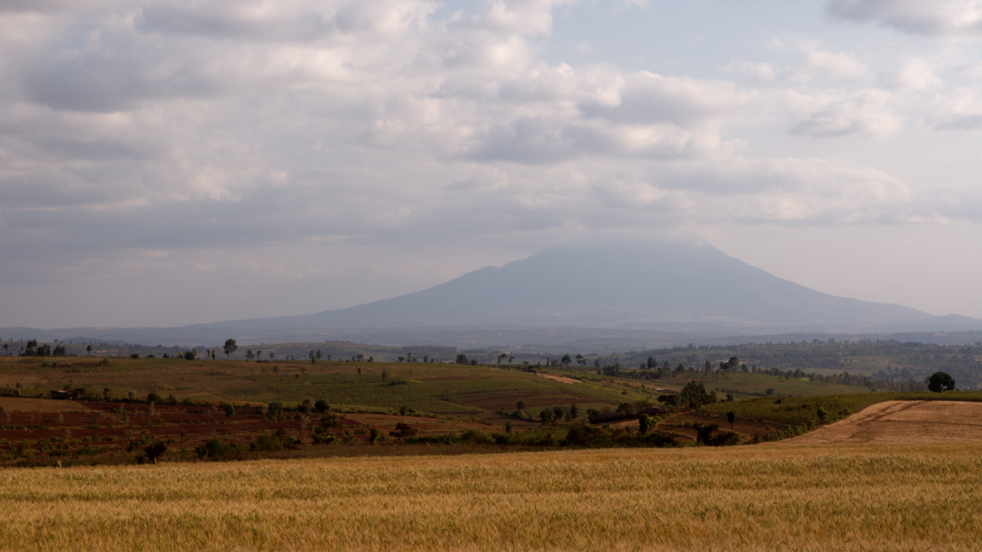
Climb Mount Hanang in a long day from Katesh village, tackling moderate slopes with well-defined paths through pastoral landscapes. The trail gains steady elevation without technical sections, making it manageable for a fit hiker. Expect quiet conditions and no crowds, as this peak sits outside national park systems. The summit offers wide views over the Barabaig grazing lands and distant highlands. Pace steadily to avoid fatigue on the final ascent. Skip this climb if relying on formal infrastructure or expecting porter support.
How this peak formed
Mount Hanang is an extinct volcano formed by volcanic activity millions of years ago, with its broad cone shaped by erosion. It sits in the Manyara region, distinct from the nearby active volcanic zones. The slopes feature volcanic soils supporting dry grasslands and acacia trees. No recent eruptions mean no volcanic gases or crater lakes remain. The terrain is mostly volcanic rock and ash deposits, weathered into gentle ridges.
What to see (5)
- ▸ Climb through Barabaig pastoralist grazing lands with traditional huts visible
- ▸ Reach the broad volcanic summit ridge with panoramic views of Manyara plains
- ▸ Observe dry grasslands dotted with acacia and baobab trees on the ascent
- ▸ Spot distant peaks like Mount Meru and the Ngorongoro Highlands on clear days
- ▸ Walk past rocky outcrops shaped by ancient lava flows near the summit
Mount Hanang rarely sees visitors outside local guides; the quietest months are June to September and January to February.
Hire a local Barabaig guide in Katesh who knows hidden shortcut trails that reduce ascent time by up to an hour.
Mount Rungwe – Southern Highlands’ Rainforest Volcano Trek
Elevation 2961 mClimb moderateBest months Jun, Jul, Aug, Sep, Nov, DecOpen +
Expect a long, steady climb through dense Eastern Arc rainforest with slippery roots and muddy patches. The trail is unmarked and requires a guide from Kyimbila or Rungwe Mission. The air cools as elevation rises, and the forest canopy shelters you from sun and wind. Summit the crater rim to find a small lake and sweeping views of the Southern Highlands. The climb demands endurance but no technical scrambling. Prepare for wet conditions and bring insect repellent. Avoid solo attempts due to trail complexity.
How this peak formed
Mount Rungwe is a dormant volcano with its last activity around 1800, featuring a crater lake at the summit. It belongs to the Southern Highlands volcanic chain, formed by rift-related volcanic activity. The mountain’s slopes are covered by thick montane rainforest, part of the Eastern Arc Mountains known for high biodiversity and endemic species like the Kipunji monkey. The volcanic soils support lush vegetation, while the crater lake occupies the summit depression formed by past eruptions.
What to see (5)
- ▸ Trek through Eastern Arc rainforest with endemic primates including the rare Kipunji monkey
- ▸ Reach the summit crater lake with reflective water and volcanic rock edges
- ▸ Pass moss-covered tree trunks and giant ferns unique to this high-altitude forest
- ▸ View the Southern Highlands’ patchwork of tea plantations and valleys below
- ▸ Spot colorful bird species endemic to the Rungwe massif along the trail
Mount Rungwe sees very few visitors year-round; the only slight uptick is during dry months June to September.
Start from Kyimbila early and ask your guide for a detour to a rarely visited viewpoint overlooking Kitulo Plateau.
Shagayu Peak – Multi-Day Village Trek Through Eastern Arc Forest
Elevation 2220 mClimb easyBest months Jun, Jul, Aug, Sep, Dec, Jan, FebOpen +
Tackle a gentle 3-4 day village-to-village trek with moderate daily distances through montane forest and farmland. Trails are well established but can be muddy after rain. The cool climate and shaded paths ease the effort. Homestays in Mtae and Mambo villages break the journey with local hospitality. The summit offers forested views and a chance to spot endemic plants like African violets. This trek suits hikers wanting cultural immersion combined with moderate mountain walking. Avoid solo travel; guides arranged by Friends of Usambara Society ensure smooth logistics.
How this peak formed
Shagayu Peak is the highest point in the Western Usambara Mountains, formed by ancient uplift and erosion of Precambrian crystalline rocks. The Eastern Arc Mountains are among the oldest in Africa, with deeply weathered soils supporting unique montane forests. The peak’s geology features gneiss and schist bedrock, heavily dissected by streams. This landscape fosters high plant endemism, including the original African violet species first described here. No volcanic activity shapes this peak.
What to see (5)
- ▸ Trek through montane forest with endemic African violets and rare orchids
- ▸ Stay overnight in Mtae village experiencing Sambaa culture and traditional food
- ▸ Reach Shagayu Peak summit with forest canopy views and birdwatching opportunities
- ▸ Pass terraced farms and small streams connecting villages along the trail
- ▸ Visit Mambo village for local crafts and community interaction
The trail remains quiet year-round; the only busy time is during local festivals when villages host visitors.
Book your trek through Friends of Usambara Society to secure homestays and support conservation efforts.
Lupanga Peak – Uluguru’s Forested Summit Close to Morogoro
Elevation 2147 mClimb moderateBest months Jun, Jul, Aug, SepOpen +
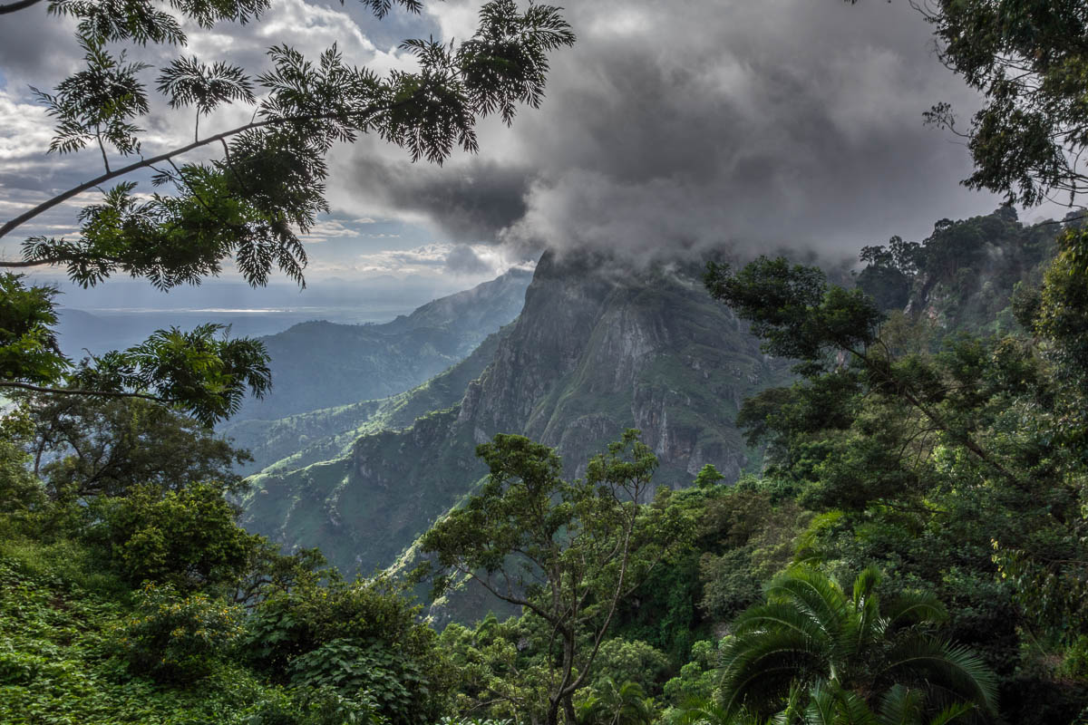
Climb Lupanga Peak in a long day from Morningside or Bunduki, navigating dense forest with unmarked trails that demand navigation skills. The terrain is steep but steady, with soft soil and roots underfoot. The forest shelters rare birds and frogs, rewarding patient hikers. The summit viewpoint offers sweeping views over Morogoro and the Uluguru foothills. Expect quiet trails with few visitors. Bring a GPS or hire a knowledgeable guide to avoid getting lost. Avoid this climb if unfamiliar with dense forest navigation.
How this peak formed
Lupanga Peak is part of the Uluguru Mountains, formed by Precambrian crystalline basement rocks uplifted over millions of years. The range is characterized by steep slopes and deep valleys carved by erosion. The peak’s geology includes gneiss and granite intrusions, supporting thick montane forest with high biodiversity. The Uluguru Mountains are a key Eastern Arc massif with endemic species restricted to these slopes. No volcanic activity influences this peak.
What to see (5)
- ▸ Ascend through Uluguru forest reserve with endemic Uluguru bushshrike and tree frog habitats
- ▸ Reach the Chenzema viewpoint for panoramic views over Morogoro town and plains
- ▸ Pass mossy forest sections with giant tree ferns and lianas
- ▸ Spot rare bird species unique to the Uluguru Mountains along the trail
- ▸ Climb rocky outcrops near the summit offering brief open views
Lupanga Peak sees very few hikers; the best quiet window is during the dry season June to September.
Hire a guide at Morningside who knows the hidden side trails to avoid confusing unsigned sections.
Loolmalasin – Remote Ngorongoro Volcano with Unmatched Crater Views
Elevation 3648 mClimb moderateBest months Jun, Jul, Aug, Sep, Jan, FebOpen +
Climb Loolmalasin only with a Maasai guide and special permission, tackling a moderate but unmarked route through highland grasslands and rocky ridges. The ascent is steady with no technical sections but requires good navigation and fitness. The summit ridge provides unparalleled views down into Empakaai Crater, a deep volcanic caldera. Expect solitude and no infrastructure on the trail. The climb demands self-sufficiency and respect for local customs. Skip this peak if lacking a trusted operator or guide.
How this peak formed
Loolmalasin is an extinct volcano in the Ngorongoro Highlands, formed by rift-related volcanic activity millions of years ago. Its summit ridge overlooks the Empakaai Crater, a collapsed caldera filled with a soda lake. The volcanic rock is heavily weathered basalt and trachyte, creating rugged ridges and cliffs. No recent eruptions or volcanic gases occur. The high-altitude grasslands and scattered shrubs dominate the landscape, shaped by volcanic soils and erosion.
What to see (5)
- ▸ Climb the summit ridge with panoramic views into Empakaai Crater’s deep volcanic caldera
- ▸ Observe highland grasslands dotted with endemic shrubs and wildflowers
- ▸ Pass rocky outcrops formed from ancient lava flows near the summit
- ▸ Spot Maasai herders and their livestock grazing on the lower slopes
- ▸ View the soda lake at the bottom of Empakaai Crater from the summit rim
Loolmalasin is almost never crowded; the only visitors appear during the dry season when permits are easier to obtain.
Coordinate your climb with a reputable Ngorongoro operator who can secure Maasai guides and permissions in advance.
Best Time to Climb Tanzania’s Mountains
The ideal months for climbing are June to October, with January and February also suitable. Avoid April and May due to heavy rains.
The climbing season in Tanzania peaks from June to October, ideal for summiting Mount Kilimanjaro and Mount Meru. January and February offer good conditions, but expect crowds. The wet season from April to May brings heavy rains, making trails slippery and dangerous, especially on steep ascents like those found on Ol Doinyo Lengai. For the best experience, plan your trek during the dry months to ensure clearer skies and safer conditions.
High-altitude climbs like Mount Kilimanjaro and Mount Meru have a narrow climbing window due to weather conditions. While Mount Hanang can be climbed year-round without significant weather concerns, the high peaks require careful timing. Kilimanjaro’s summit attempts are best in the dry months, while Meru’s technical routes also benefit from the same window. Avoid attempting high-altitude climbs during the rainy season to reduce risks associated with slippery trails and poor visibility.
Staying Safe on Tanzania’s Mountains
Climbing in Tanzania presents unique challenges, from altitude sickness to volcanic hazards. Understanding these risks is crucial for a safe and successful ascent.
- Monitor volcanic activity before climbing Ol Doinyo Lengai; check with local guides for current conditions and exclusion zones around the crater.
- Prepare for extreme temperatures on Uhuru Peak; summit night can drop to -25°C, so pack adequate cold-weather gear.
- Ensure you have an armed ranger escort when climbing Mount Meru; the trail crosses areas inhabited by buffalo and elephants.
- Acclimatize properly before summiting Mount Kilimanjaro; failure to do so increases the risk of altitude sickness significantly.
- Stay hydrated during the climb on Mount Hanang; water sources are limited, so carry enough for the entire trek.
- Be cautious of loose scree on the descent from Mount Meru; it can lead to slips and falls, especially in the dark.
Preparing for Tanzania’s Peaks
Preparation is crucial for climbing Tanzania’s mountains, especially with their diverse climates and altitudes. Proper acclimatization and physical training can significantly enhance summit success rates, while understanding permit requirements ensures a smooth experience. Each peak presents unique challenges, making tailored preparation essential for achieving your climbing goals.
Start Physical Training Early
Begin a fitness regimen at least three months before your climb, focusing on endurance and strength training to prepare for the sustained effort required on peaks like Kilimanjaro and Meru.
Research Climbing Routes
Study the specific routes for your chosen peak, such as the Lemosho route on Kilimanjaro, to understand the terrain, elevation gain, and acclimatization needs.
Check Permit Requirements
Verify the necessary permits for your climb, especially for Kilimanjaro and Meru, where guided treks are mandatory and permits must be booked through registered operators.
Plan Acclimatization Days
Incorporate acclimatization days into your itinerary, particularly for Kilimanjaro, where longer routes like Lemosho improve summit success rates significantly.
Gather Essential Gear
Ensure you have the right gear for your climb, including warm clothing for Kilimanjaro’s summit night, sturdy hiking boots, and trekking poles for stability on steep sections.
Monitor Weather Conditions
Check weather forecasts for your climbing dates, as conditions can change rapidly, particularly on Kilimanjaro and Meru, affecting visibility and safety.
Establish Emergency Contacts
Identify local emergency contacts, including your guide service and nearest medical facilities, especially when climbing remote peaks like Ol Doinyo Lengai.
Hydrate and Fuel Up
Prioritize hydration and nutrition in the days leading up to your climb, ensuring you’re well-prepared for the physical demands of summiting peaks like Rungwe and Hanang.
Choosing the Right Peak
Mount Hanang offers a moderate climb with no park fees, making it ideal for first-time climbers seeking a less technical ascent without the crowds found on Kilimanjaro.
Mawenzi is perfect for experienced climbers looking for a technical challenge; its Class 5 climbing requires skills and offers stunning views, making it a rewarding objective.
For those eager to witness a unique sunrise, Ol Doinyo Lengai’s overnight scramble culminates in breathtaking views of active volcanic features at dawn.
Shagayu Peak combines moderate hiking with cultural immersion, as trekkers can experience local villages and unique flora while enjoying the scenic landscape.
Mount Meru is ideal for those seeking a multi-day trek that builds acclimatization for Kilimanjaro, offering technical challenges and stunning views along the way.
Volcanoes and Peaks in Tanzania
1What is the best time to climb Mount Kilimanjaro?
The best months to climb Mount Kilimanjaro are January, February, June, July, August, and September. These months typically offer clearer skies and more stable weather, enhancing your chances of a successful summit.
2Do I need a guide for Ol Doinyo Lengai?
Yes, a mandatory Maasai guide is required for climbing Ol Doinyo Lengai. This ensures safety during the challenging ascent and provides local insights into the volcano’s unique features.
3How difficult is the climb to Mawenzi?
Mawenzi is a technical climb requiring Class 5 rock climbing skills. It is not suitable for trekkers; only experienced climbers should attempt it, as it demands specialized gear and training.
4Is there water available on the route to Mount Meru?
Water sources are limited on the Mount Meru route. Climbers should carry sufficient water from the base and plan to refill at designated camps, ensuring hydration throughout the trek.
5What permits are needed for Mount Rungwe?
While no formal permits are required for Mount Rungwe, hiring a local guide is mandatory due to the unmarked trails. This ensures safety and navigation throughout the climb.
6Can I climb Loolmalasin without a guide?
No, climbing Loolmalasin requires a special permit and a Maasai guide. Attempting the climb without these arrangements is not permitted and can lead to safety issues.
7What should I expect on the summit night of Kilimanjaro?
Summit night on Kilimanjaro involves a midnight start, climbing in freezing temperatures, and navigating loose scree. Expect extreme cold and altitude challenges, so prepare for a physically demanding experience.
8Is Mount Hanang suitable for families?
Yes, Mount Hanang is suitable for families with teens. Its moderate slopes and lack of technical sections make it accessible for fit family members looking for a rewarding day hike.
Some links on this page are affiliate links. We may earn a small commission at no extra cost to you when you book through them.